|
Of
Bears and Bikers |
|
|
|
Personal Memories
of ROCKY MOUNTAIN 1200 in July 2000
by Hubertus Hohl |
|
ROCKY MOUNTAIN 1200 is a relatively young
randonneur event in West Canada, which first started in 1996.
It was held the fourth time this year from July 26-30th under
the rules of "Randonneurs Mondiaux", a worldwide organization
promoting long-distance cycling. Having participated at Paris-Brest-Paris
in 1999, I got attentive to this long-distance ride, because
corresponding invitations were displayed there. Since I looked
for a similar challenge this year again, I was quickly determined
to concentrate on riding Rocky Mountain 1200 this season. The
announcement sounded very promising: many climbs and five major
mountain passes up to 2000m altitude, spectacular landscapes
and wildlife, besides deer, elk and moose also bears were mentioned.
Hindsight, it's safe to say, these characterizations became true.
But RM1200 also turned out to be a unique experience for several
other reasons: meeting and riding with other randonneurs, getting
excellent support on the route as well as mastering unforeseen
imponderableness, which are typical for such an event.
The Route
Start and finish are set in Kamloops, the
largest, but not very attractive city in the hot and dry interior
of British Columbia, situated 365km north and east of Vancouver.
In a large triangular loop, the route of 1210km runs through
the Canadian Rockies of British Columbia and Alberta which offer
breath-taking mountain scenery and wildlife to the riders. The
first 300km of the route head valley upwards. The final 300km
mainly traverse hilly farm country. The middle section of the
route first passes through the heart of the Canadian Rockies,
the glacier world of the well-known Icefields Parkway. Then,
the route traverses Yoho National Park, Glacier National Park
and touches Mount Revelstoke National Park; lonely wild-life
reserves with evergreen forests, cyan gleaming mountain lakes
and snow-covered peaks, which offer fascinating contrasts to
the densely populated and often overcrowded European Alps.
Certainly, the two most challenging parts
of the route are the long climbs to Columbia Icefield (2035m),
an enormous glacier area 120km south of Jasper, as well as to
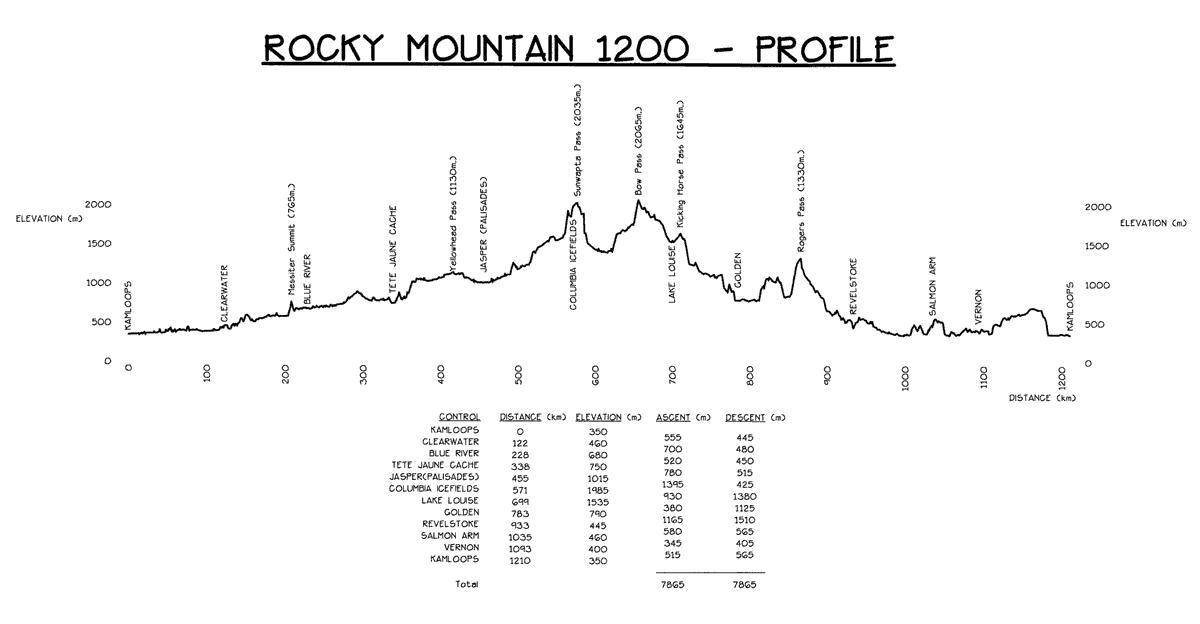
Bow Pass (2065m), the highest point along the route. With 7865m
total elevation gain the route appears relatively harmless at
first sight - compared to PBP with more than 9000m -, but the
distribution of the elevation gain on the chart below quickly
shows that RM1200 is definitely not easier to ride from a physical
point of view. While thousands of rolling hills are typical for
PBP, RM1200 features some very long, but rarely steep climbs
which cover large distances in elevation and which are interspersed
with lots of descents and flat stretches. For European bikers
touring the Alps this is a very new experience: While typical
passes in the Alps usually master 1000m elevation gain with an
average gradient of 8% or more in the course of 10km, the same
elevation gain on a typical RM1200 climb requires a distance
up to 100km long, but usually no more than 5-7% steep in the
ascending slopes. Also, due to the downhills on this distance,
up to 500m elevation loss are mastered additionally. Comparing
the descents, similar considerations apply.
[Rocky Mountain 1200 elevation
profile]
In the afternoon of July 26 registration
and bike check take place in a recreation building in Kamloops.
I meet a colored mixed field of participants with some well-known
faces. 39 riders from 6 nations, 2 women and 37 men, present
themselves: 12 Canadians, 17 Americans, 2 British, one Dane,
one Australian and 2 Germans. I have met the other German rider,
Andy Wimmer, at the 600k qualification brevet in Vienna. Andy
is a young rookie who never did a 1200k event before. He is nonetheless
in good shape and appears not at all exited. Stig Lundgaard,
a young Dane, already participated in the Scandinavia 2000k this
year and intends to also ride Boston-Montreal-Boston in August;
in truth an extraordinary performance. 10 riders are "repetition
culprits" who have already completed the tour up to 4 times.
Old Jack (Jack Eason) is here, too. At
73 years he is the oldest rider, an Englishman on an ancient,
frog-green painted steel horse with a big fanfare horn. Old Jack
is an old stager in the randonneur scene. He has already completed
over two dozen 1200km events. With his age, his experience and
his staying power, he surely is a model for many younger riders.
Another 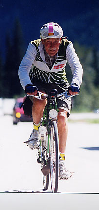 Englishman
enters the ride in classical British style with a rigid rear
wheel hub. Most other riders are conventionally equipped, many
are using aero-handlebars which are permitted. For this route,
aero-handlebars provide a very meaningful relief on long descents
and flat sections. Englishman
enters the ride in classical British style with a rigid rear
wheel hub. Most other riders are conventionally equipped, many
are using aero-handlebars which are permitted. For this route,
aero-handlebars provide a very meaningful relief on long descents
and flat sections.
Bike inspection and registration run without
problems. Danelle Laidlaw, who organized this tour with great
devotion, hands over my control card and the route sheet. I decide
to start next morning at 4.00am, so do 17 other riders. I also
deposit 3 supply bags, which are transported by the organizers
to three freely selectable checkpoints along the route. Contrary
to PBP, RM1200 is a "full board" event: showers and
sleeping accommodations as well as refreshments and warm meals
at the control points, bag drop service, the traditional post-ride
party and commemorative plaques and medals for the finishers
are all included in the registration fee (Can$ 250-300).
I can recognize by the labelled bags that
most riders deposit their bags at three indicated checkpoints
which offer adequate sleeping accomodations: at Jasper (km 455),
Golden (km 783) and Salmon Arm (km 1035). Therefore, Danelle
is surprised when she notices that my first bag is already intended
for Tete Jaune Cache (km 338). Anxiously, she suggests that sleeping
just after 300km would be too early to complete the event in
time. Of course, she is quite right, but I plan to master the
route according to the following personal strategy: Based predominantly
on completely balanced liquid nutrition, mineral drinks with
lots of carbohydrates, supplemented by additional meals at some
checkpoints, I intend to cut the route into 4 sections of equal
length (approximately 300km) and to deposit my bags at the corresponding
controls: at Tete Jaune Cache (km 338), Columbia Icefields (km
571), and Revelstoke (km 933).
After the race, Danelle told me groaningly,
how she knew immediately that she had one of my bags in her hands:
these were definitely the heaviest ones! Well, that's not astonishing,
because I have put the complete ration for the next 300km section
in each bag: 1.5 liter of mineral water and 2-4 bags of powder
for mixing mineral drinks, 11 cans of EnsurePlus (a liquid nutrition
with 355 calories per 235ml), 5 PowerBars, 3 cans of Coke, honey
cake (for me, not for the bears), various clothing to change
and for cold and rainy conditions in the mountains. I knew that
I would hardly need the whole food and beverages, but you never
can tell... My bike is loaded with a frame bag containing 4 cans
of liquid nutrition, some bags with mineral powder and PowerBars,
with a water bottle filled with three more cans of liquid nutrition,
with a second bottle containing mineral drink, with a large saddle
bag containing extra clothes, and with a handlebar bag stuffed
with various other things, such as a Petzl headlight, a reflective
vest, a rain jacket, etc.
I plan to take the first sleep break after
two sections at Columbia Icefields. Furthermore, the maxim applies:
adequate sleep each night (approx. 3 hours), no hurry at the
checkpoints, sufficient time to talk with other riders and with
the volunteers who care for us. Being in the Canadian Rockies
for the first time, I want to enjoy this ride and the breath-taking
landscape as much as possible.
Reasonably almost all riders come without
a support crew. Only two or three riders completely rely on a
crew, among them Ken Bonner, the later winner, who wants to beat
the current record time. Surely, you can ride faster with the
help of a crew by minimizing the load on your bike and the rest
breaks. Nonetheless, I think that support vehicles are generally
unnecessary for this event in the presence of the complete service
at the checkpoints and the bag drop possibilities.
While Andy and the other 10.00pm riders
prepare for their start, I am trying to find some sleep in my
pickup camper. Getting up at 3.00am, an amazingly warm western
wind blows with 20 C, so that I don't need to put on my arm and
leg warmers. After a short briefing into the route and some advice
on dealing with wildlife, especially bears, we punctually start
at 4.00 o'clock. We are still joking about the bears, although
we all probably feel a bit ticklish to encounter one of this
species, particularly at night. In principle, bears are very
shy animals which avoid human beings. I didn't encounter a single
bear the week before, when I toured some national parks with
my camper and my bicycle. But soon, this should change...
The first section:
Kamloops - Tete Jaune Cache (km 338)
The first 338km of the route follow the
North Thompson River up-stream on Highway #5. This mighty river
forces its way through a lonely valley with evergreen forest.
No building, no sign of civilization within many kilometers.
Just endlessly long freight trains drafted by the powerful redbrown
diesel engines of the "Canadian Pacific Railroad" which
runs parallel to the highway, drown the rustling river. After
a few kilometers, a group of four riders constitutes to make
a fast pace towards 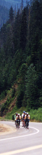 Clearwater,
the first checkpoint (km 122). Periodically, we are changing
lead position, so time goes by quickly. Suddenly, 6 kilometers
before Clearwater I discover a sneaking flat in my rear tire.
It is of no use going on, so I let go the other riders who want
to help me and start replacing the tube. Fortunately, the cause
of the puncture is quickly found: a piece of wire from a damaged
truck tire has pierced the tire tread. Unfortunately, such remains
are encountered frequently on the shoulders of Canadian highways.
Since I carried only two spare tubes, I now decide to buy another
one as soon as possible. Clearwater,
the first checkpoint (km 122). Periodically, we are changing
lead position, so time goes by quickly. Suddenly, 6 kilometers
before Clearwater I discover a sneaking flat in my rear tire.
It is of no use going on, so I let go the other riders who want
to help me and start replacing the tube. Fortunately, the cause
of the puncture is quickly found: a piece of wire from a damaged
truck tire has pierced the tire tread. Unfortunately, such remains
are encountered frequently on the shoulders of Canadian highways.
Since I carried only two spare tubes, I now decide to buy another
one as soon as possible.
My stop at the first checkpoint in Clearwater
(the parking lot of a closed gas station) is very short: mixing
a Gatorade drink, filling up a water bottle, and I am back on
the road again. After a few kilometers the first raindrops touch
my skin. I am riding straight into a threateningly black rain
front spreading the whole valley. Although it's raining it remains
relatively warm (18 C) and calm, so I can make a fast pace -
mostly alone or chatting with some riders who I pass. The second
checkpoint, a motel room in Blue River (km 228), not only offers
refreshments (bananas, cookies, juice, water) but also pasta
out of the microwave. Short of the third checkpoint in Tete Jaune
Cache (km 338), it stops raining. The rest of the day it should
remain dry with temperatures around 20 C. Now, the North Thompson
valley broadens and uncovers an impressing view of snow-capped
mountain ranges standing up to both sides of the valley. The
route running straight towards Tete Jaune Cache for the last
kilometers has reached its most northern point here. It now turns
south-east on Highway #16 entering the Rockies over Yellowhead
Pass towards Jasper.
As I enter the checkpoint at 3.00pm, Ken
Bonner who is on his way towards Jasper goes by with a wave.
Ray Wagner, another rider of our initial group is already sitting
in the motel room. I am looking forward to my first bag that
is dropped here. The smiling volunteer who maintains the control
is awfully curious about the contents of my bag which is so heavy.
While packing my bike with a new load of liquid food and PowerBars,
I explain my personal nutrition strategy. Nevertheless, he seems
to be a bit disappointed that I prefer my liquid nutrition to
his warm plate of pasta.
The second section: Tete Jaune Cache - Columbia Icefields
(km 571)
The climb over Yellowhead Pass towards
Jasper promises to be more strenuous but also more varied than
so far. As I climb the first ascending slope out of Tete Jaune
Cache, a stormy wind is blowing down the valley. The road is
stepwise winding up the valley. Gradual ascents are interrupted
again and again by flat stretches of road along the joung Fraser
River. Then, the route enters Mount Robson Provincial Park. The
entrance to the park is marked by the well-known stone monument
with the white mountain goat pointing to Mount Robson, the highest
peak of the Canadian Rockies (3954m). Unfortunately, as so often,
Mount Robson doesn't show itself. Only the huge lower part of
the clouded giant whose peak is covered with glaciers is visible.
Yet this view is very impressive. I feel rather tiny on my bike
in view of the giant standing up into the clouds.
Somewhere at
Moose Lake I pass Old Jack who is slowly but steadily struggling
for the summit. I encourage him and start catching other 10 o'clock
riders who are appearing now and then ahead of me on the long
straight stretches of the highway. Meanwhile, the sun is setting
and only few vehicles are on the way. Suddenly, one hundred meters
ahead of me a huge dog with bright pitch black coat appears trying
to cross the road. Queer, I think, Canadian dogs seem to be much
bigger than European ones. I have never seen such a big dog in
my whole life. Like a blow, I realize that the dog in fact is
a grown-up 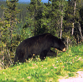 black bear. I slow down and stop, thinking
of the rules that were told us in case we should encounter a
bear: stay calm, talk to the animal, back away slowly, but don't
run. The bear is observing me but doesn't dare to cross the road.
Maybe he is just figuring out whether the species "skinny
German cyclist" rather belongs to the "eatable"
or "uneatable" category of food. But it seems the bear
is more afraid of me than I am afraid of him. However, I just
don't feel like passing by this muscle-packed animal, turning
round is maybe the better choice. Still undecided what to do,
a noisy car rushes by, the bear quickly turns and in big leaps
races into the near wood. Alleviated, but also euphoric, I pedal
as fast as I can. Wow, my first real bear in the wild! This is
precisely what makes Rocky Mountain 1200 such a thrill. Some
hundred meters further along the road, I can see a family calmly
picknicking on a parking lot at the roadside. If they knew... black bear. I slow down and stop, thinking
of the rules that were told us in case we should encounter a
bear: stay calm, talk to the animal, back away slowly, but don't
run. The bear is observing me but doesn't dare to cross the road.
Maybe he is just figuring out whether the species "skinny
German cyclist" rather belongs to the "eatable"
or "uneatable" category of food. But it seems the bear
is more afraid of me than I am afraid of him. However, I just
don't feel like passing by this muscle-packed animal, turning
round is maybe the better choice. Still undecided what to do,
a noisy car rushes by, the bear quickly turns and in big leaps
races into the near wood. Alleviated, but also euphoric, I pedal
as fast as I can. Wow, my first real bear in the wild! This is
precisely what makes Rocky Mountain 1200 such a thrill. Some
hundred meters further along the road, I can see a family calmly
picknicking on a parking lot at the roadside. If they knew...
The Yellowhead Pass itself (1130m) is undistinguishedly
embedded into a broad wooded valley with deepgreen mountain lakes.
Just a sign marking the continental divide between Atlantic and
Pacific ocean indirectly points to the summit. The Yellowhead
Pass marks the border between British Columbia and Alberta. Also,
the time zone is changing now to "Mountain Standard Time",
one hour ahead. However, since all time specifications on the
tour are generally based on "Pacific Standard Time",
I don't need to put on my clock. Shortly after the summit, I
am passing the entrance into Jasper National Park. There is a
Can$5 per day charge for entry into the park, even for cyclists.
The following descent down to Jasper is rather unproductive.
The summit is only about 100 meter elevation above Jasper.
Located a few kilometers east of Jasper,
a log-house made available by the park wardens is used as a checkpoint.
Andy is totally surprised when I arrive at 7.25pm. "You
are really a beast!", he is shouting, shaking his head as
I confess having maintained a pace of nearly 32 kilometers per
hour for the first 455 kilometers. Andy, having arrived one and
a half hour ago intends to sleep in the lodge till 2.30am. So
do the other 10 o'clock starters. Likewise, they declare me crazy
as I intend to climb Columbia Icefield just after a short break.
But I am used to being considered crazy, so I don't care much.
My PBP experience last year showed me that after 15 hours riding
time I am still too chirpy to sleep well to some extent. I suppose,
Danelle would have preferred me taking a sleep break at Jasper,
too. So now, she must drive to the cefield just to deposit my
bag there. As I come to know later, Brian Leier, Ken Carter and
Arvid Loewen who arrive at the lodge shortly before my departure,
are also determined to ride up to the cefield at night.
In the meantime Ken Bonner leaves the control.
He assumes that I will be heading out soon, but I want to make
a longer break to relax, talk with other riders, fill up my glycogen
stores, mount my headlight, and put on arm and leg warmers. It
should be the last time on the tour that I catch sight of Ken.
I eat a warm plate of lasagne and mix an obligatory drink with
Gatorade powder which is available at all checkpoints. One and
a half hours later, I'm ready to start. Bob who accompanies the
riders with his heavy motor-cycle informs me about the weather
conditions on the way up to the icefield. Meanwhile, dark clouds
have gathered threateningly over the mountains in the twilight.
But Bob thinks that it won't rain at night. And I should not
be afraid of bears, he laughs, unless they are lying in wait
for me in the bushes. And so I'm heading out on the 120km climb
into the rising darkness.
Bob should be right. Except for some faint-hearted
raindrops it remains dry. The bears too all seem to have gone
to bed meanwhile. It should be a silent night ride up to the
glacier. Shortly after Jasper, I am virtually alone on the highway.
Hardly encountering cars that might dazzle me, I soon find a
steady rhythm to climb the gradients along the Athabasca River.
The night ride becomes varied because of the many signs marking
attractions along the parkway. In the light of my headlamp, I
can read signs pointing to Athabasca Falls, Sunwapta Falls, and
Stanley Falls. Hearing the rustling water, I try to picture the
corresponding scene to myself. So, time is passing quickly. At
some time or other, Bob appears on his motor-cycle stating that
I would still be doing very well. But, for some time I'm experiencing
problems with my left knee. While extending my leg strain occurs
in the outer tendon at the knee, especially when going out of
the saddle. By increasing cadence and applying less force to
the left pedal, I try to relieve my knee. However, although endurable,
the pain remains. Anxiously, I wonder whether I have ridden the
first 500 kilometers too powerful, but I never ever experienced
strain like this before. I hope that the problem goes away of
itself when taking a sleeping break at Icefield.
At midnight, half-way to Icefield, I pass
a luxury and brightly illuminated lodge at Sunwapta Falls. Obviously,
this lodge is the only inhabited place between Jasper and Icefield.
I dispose of my empty cans of liquid nutrition and pedal on.
Now, the parkway is stepwise winding up the valley. At some exposed
places an astonishingly warm wind is blowing down the mountains.
Suddenly, a short 10% grade appears blasted into the rock and
the road sweepingly turns into a stony and windy high-lying valley
hosting Icefield Centre (1985m), a huge building with restaurants
and shops that serves as a starting point for guided tours onto
the glacier. Unfortunately, it's so dark that neither Columbia
Icefield itself nor its large tongue stretching out the basin
of the valley are visible. Now, the planned sleeping break comes
in handy, so I can cast a glance at the glacier by daybreak.
Riding through the huge but empty upper
parking lot for buses at 2.40am, Danelle and her volunteers already
await me with a warm plate of pasta inside the warm lobby. At
this time of day, the lobby is empty except for some scrub women.
As Andy tells me after the tour, the situation is totally different
at 9.30 in the morning when he arrives at Icefield Centre. The
parking lot is fully occupied and the lobby is crowded with Japanese
tourists who are waiting for a bus trip on the glacier.
Wrapped up in a blanket, I lie down on
a wooden bench inside the lobby. Fortunately, I have put some
spare clothes and some foam pads (intended to be wrapped around
the saddle in case of saddle sores) into my "Icefield"
bag, so I can stuff the hard bench a bit. After 571 kilometers
and exactly 20 hours riding time, I fall into a broken sleep...
The third section:
Columbia Icefields - Revelstoke (km 933)
My body clock wakes me up shortly before
6.00am. I slobber a warm plate of oatmeal porridge offered by
the volunteers and prepare myself for the second half of the
tour. It is drizzling outside. Low clouds are covering the glacier's
front which has taken on a dirty gray hue. I'm a bit disappointed
because I have expected a more impressive view of the icefield.
However, the huge and magnificient snow-white glacier can not
be seen from the Centre even at good sight. You have to make
at trip on the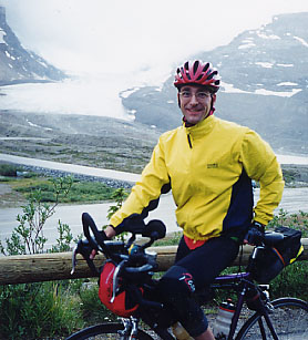 glacier with one of the special buses. All the well-known picture
postcard motives of the glacier are taken from a higher point
of view, too.
glacier with one of the special buses. All the well-known picture
postcard motives of the glacier are taken from a higher point
of view, too.
Dozing on a wooden bench next to me, Bob
is astonished to see me yet. He thinks that I'm already off and
away because Brian and Arvid who arrived some time after me,
have already left the control without any longer sleep break.
Telling Bob, that I absolutely wanted to see the icefield at
daylight, he spontaneously takes a picture of me in front of
the glacier scenery.
After riding some hundred meters the already
forgotten pain in my knee becomes perceptible again. I'm rather
frustrated. While passing Sunwapta summit (2035m) I ponder over
the possible cause of the pain. Suddenly, I remember having glued
a 2mm thin tape onto the inner part of the sole of my left cycling
shoe two weeks ago. The tape should keep the insole in a fixed
position. Immediately, I stop and remove the tape. And behold!
The pain disappears like a blow. Apparently, the tape caused
my left foot to tilt a little bit outwards. So the outer tendon
of my left leg has been overstretched, causing strain after 500
kilometers. It is astonishing again and again how painful effects
can be caused by minor modifications to shoes, saddle position,
etc.
Relieved I start descending into a huge
canyon. The road is winding down the rocky walls into the broad
valley ground of the Saskatchewan River. After 50 kilometers
at Saskatchewan River Crossing the river breaks eastwards through
the mountain chain into the extensive plains of Alberta. Time
and again I meet small groups of rider on their way going by
with a wave. I assume, they belong to one of the organized Parkway
bike tours offered by some local promotors.
At Saskatchewan River Crossing, the road
is ascending southwards towards Bow Pass (2065m), the highest
point along the route. This 36km long climb is particularly insidious.
From a distance the summit seems to be located on a wooded pass
apparently near at hand. However, approaching the presumed location
I do not gain any considerable elevation. My altimeter oscillates
at 1600m. The climb is dragging on and I am desperately looking
for the summit which must be 400m higher. Finally, a few kilometers
before the pass, the road is steeply winding up to its highest
point, a sparsely wooded top. On this section I pass Arvid who
seems to live through similar experience. Apparently, he is not
in a good shape. He hopes to regenerate on the following 43km
long descent down to Lake Louise Village (1535m). Arriving at
the top, the magnificent view of picturesque Bow Lake and Bow
Glacier compensates for the trouble. In wide curves the road
is going down to Bow Lake, following Bow River down-stream along
the main range peaks, passing the huge Crowfoot glacier, touching
lonely turquoise lakes hidden in the evergreen forest and idyllically
situated campgrounds with characteristic names, such as "Mosquito
Creek". Shortly before the village, the majestic mountain
chain surrounding Lake Louise, one of the most visited places
in the Rockies, comes into view. Now, after 700km, the route
turns westwards onto the Trans-Canada Highway.
Having rested for half an hour at the checkpoint
inside a recreation center, I suddenly remember that I wanted
to buy a second spare tube after my flat. The Trans-Canada Highway
with a lot of commercial traffic especially seems to be suspectible
to flats. To be on the safe side, I decide to buy a spare in
a nearby bike shop. I am just entering the shop when one of the
volunteers of the control who followed me hands over a spare
tube. Arvid, who shortly arrived after me, carried one in his
bag for Lake Louise. An obvious idea that I have overlooked entirely
when preparing my bags.
Meanwhile it has become noon. The sun is
burning big holes into the cloudy sky. Temperatures are pleasant
around 19C. The next section to Golden (km 785) promises to be
easy. A short and harmless climb to Kicking Horse Pass (1645m)
is followed by a fast descent into the heavy wooded Yoho River
Valley leading to Golden. However, traffic has increased noticeably.
Many heavy trucks are passing by with a pace of 100km/h and more.
Fortunately, there's a very wide and smooth shoulder I 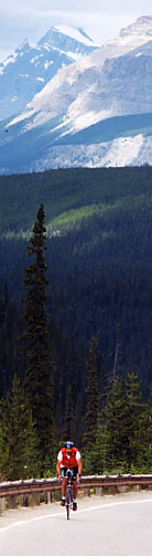 can ride on, so I feel quite safe.
Compared to the busy and fast paced Trans-Canada Highway, the
Icefields Parkway represented an oasis of silence in the midst
of cars and motorhomes pleasantly chugging along. can ride on, so I feel quite safe.
Compared to the busy and fast paced Trans-Canada Highway, the
Icefields Parkway represented an oasis of silence in the midst
of cars and motorhomes pleasantly chugging along.
The steep descending slope of Kicking Horse
Pass is announced by a "brake check zone". Heavy trucks
exceeding a certain total weight must check their brake systems
here before crawling down long and steep slopes with the warning
flasher turned on. The Canadian Pacific Railroad which runs parallel
to the highway spectacularly surmounts the difference in elevation
by means of two spiral tunnels. The long freight trains can be
observed leaving the tunnel at one side while the other end still
enters the tunnel one hundred meters below in the opposite direction.
Some kilometers before Golden one more
sign pointing to a brake check zone appears. The road is descending
into a narrow canyon with vertical rocky walls. Deeply down below
the railroad is twisting through tunnels and bridges along the
valley floor. After traversing two bridges at the valley floor
the highway is rising again. Unfortunately, there is no shoulder
on this narrow stretch of road. I am forced to climb in the lane
drafting a long queue of vehicles. Fortunately I am prepared
for this sinewy situation since I travelled this section with
my bike the week before the race. Shortly afterwards a great
view of Golden and the Columbia River opens up. I can easily
find the checkpoint in Golden following the big yellow "Tour
BC" signs that have been set up by the organizers around
all controls.
As I enter the recreation center in Golden,
nobody seems to be present at first sight. Then the nice and
drowsy volunteer who had a bit of shut-eye in her sleeping-bag
appears serving me a warm plate of pasta. It is evident that
this event demands a great deal of energy and lack of sleep not
only from the riders but also from the volunteers. Sometimes
there are 24 hours difference between the first and the last
rider at a control. So many volunteers will not get a wink of
sleep all night.
She informs me, that the first and second
rider, Ken and Brian, are three and a half hours and one hour
ahead, respectively. Meanwhile, the temperature is much warmer
around 25 C, but the weather in the Columbia mountain range which
must be traversed in the next section doesn't look well at all.
A huge black rain front and a strong squally headwind point at
heavy rain in the mountains. Nevertheless, I decide to tackle
the 150km section over Rogers Pass (1330m) to Revelstoke and
to set my mind on a rainy nightride. My traveler's guide states
that the area around Rogers Pass in the Glacier National Park
is noted for heavy rain even in summer. Statistically, it's raining
or snowing 3 out of 5 days all the year round. Unfortunately,
I seem to have caught exactly one of these rainy days. But staying
in Golden is not a good alternative. It is not before 4.00am
and my next bag is waiting for me in Revelstoke. So I set out
quickly.
A few kilometers after Golden it starts
raining steadily. I make a break to put on my rain gear. At least,
the tailwind abates now. After a short time I'm dripping with
water and dirt squirted by passing trucks on the busy Trans-Canada
Highway. After 30km a series of four long grades leads the Highway
over a wooded mountain-ridge into the Glacier National Park which
is on Pacific Time again. Because of deep clouds and continuous
rain I can not see much of the scenery. Then a sign and an open
avalanche gate point to the final climb to Rogers Pass. This
is a 6km long slope of 8-9% gradient without any noticeable curves.
Some tunnels protect the road which is suspectible to avalanches
in winter. Fortunately, the wide shoulder continues inside the
tunnels, so they can be easily traversed even though the infernal
noise of passing trucks is rather sinewy. Moreover, the second
tunnel is bent in a smooth s-shape curve so I'm totally surrounded
with darkness for a short time.
When reaching the Visitor Center at the
pass around 8.15pm, it is not too cold with temperatures of 12
C. The area is like a ghost town. The center is already closed.
Even the Columbian Ground Squirrels which usually pose on the
grass in front of the center during the day have disappeared.
Mounting my headlamp I set out for the 70km long descent into
Revelstoke. Actually, the first 20 kilometers form a high speed
descent into a deeply cut high-lying valley crowned by beautiful
glaciers. But after some meters it is obvious to me that this
descent will become very difficult today. It has become dark
and the still strong oncoming traffic dazzles me, so I cannot
see the road in front of me in the pouring rain. Actually I'm
blind flying, because the light of the cars is reflected and
broken by the raindrops on my glasses. For a moment, I strongly
consider riding back on the pass to stay in the Best Western
Lodge overnight. But then I decide to crawl down carefully. Fortunately,
the oncoming traffic weakens more and more and it stops raining
with time. Suddenly, I notice a very loud, clicking noise emerging
from the real wheel hub or bottom bracket with every revolution
of the crank. Great, I think, an irreparable fault in this god-forsaken
region - it only wanted that! I must remember the 600km Vienna
brevet in June, where I had to carry out the second 300km with
just one sprocket available (17 or 19) because of a broken spring
in my right-hand Campa Ergopower lever. But I made it amazingly
well at that time, thus I decide to simply ignore the noise and
its possible causes. Courageously, I keep stepping into the pedals,
clack, clack clack... Actually, it helps: after a sinewy hour
the noise is gone all of a sudden. I reach Revelstoke without
further problems briefly before 11pm.
In the Canyon Motor Inn Motel I see Brian's
bike standing on the thick filled carpet in front of room #24.
I place my dripping bike near it. Peter and Mejbritt, the Danish
girl friend of Stig Lundgaard are waiting for me inside the room.
Brian is already sleeping in one of the beds. After having a
great hot shower, I am very glad to slip into new and dry cycling
clothes out of my bag. After having a warm plate of Lasagne,
I decide to sleep for 3 hours. Peter communicates to me that
Brian will already set out at 0.30am. Dozing off, I can hear
Arvid arriving. Because of a wrong turnoff, he spent a lot of
time trying to find the motel wandering around the deserted village.
Besides me, Arvid is the only rider who dared to descend from
Rogers Pass at night. Another rider abandoned the descent after
some kilometers and turned around to Rogers Pass to stay in the
Best Western Lodge overnight. As I get to know after the ride,
all other riders stayed in Golden overnight. As Andy tells me
later, the night was not very comfortable because the mats were
extremely hard. He even things that he was absolutely shattered
in the morning and much more exhausted than before. To compensate
for the uncomfy night he could enjoy traversing Rogers Pass the
next day without any rain in bright sunshine.
Shortly before 3.00am, I wake up. Arvid
already prepares for setting out. We are served an excellent
breakfast. In the meantime, Peter has covered the floor under
our bikes with plastic foils to preserve the carpet. As I notice
but now, Peter and Mejbritt have spent the night on the floor,
since we had occupied the beds...
The final section:
Revelstoke - Kamloops (km 1210)
When crossing the large steel bridge over
the dammed up Columbia River, the road is still wet. The next
section on the Trans-Canada Highway is mainly rolling hills interspersed
with two larger ascents towards Salmon Arm (km 1035), a small
town at the Shuswap lakes. The road is not much frequented at
this time. I keep a quick pace that Arvid does not want to follow.
So, soon again I am alone on the way. The route leads by a wooded
valley along the transcontinental railroad connecting Atlantic
and Pacific. Aside from two strange and kitschy attractions at
the roadside, a ghost town at Three Valley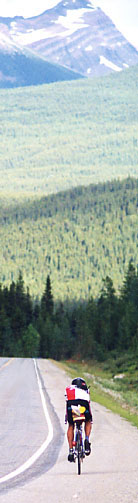 Gap and a fairy tale garden called "The
Enchanted Forest", the area appears unaffected and lonely.
Suddenly, 60km after Revelstoke, the route leaves the highway,
turning right over an open crossing onto a small by-road with
rough surface. Now, the route idyllically runs along some nice
properties in the valley. I am wondering about this bypass particularly
since the route sheet shows that this road will join the highway
again 12 kilometers farther at Sicamous. Actually, the only reason
seems to be a secret control somewhere along the by-road. But
this control does not show up. As Danelle ensures me afterwards,
she indeed planned a secret control here, but it had to be cut
out because of a lack of volunteers. Gap and a fairy tale garden called "The
Enchanted Forest", the area appears unaffected and lonely.
Suddenly, 60km after Revelstoke, the route leaves the highway,
turning right over an open crossing onto a small by-road with
rough surface. Now, the route idyllically runs along some nice
properties in the valley. I am wondering about this bypass particularly
since the route sheet shows that this road will join the highway
again 12 kilometers farther at Sicamous. Actually, the only reason
seems to be a secret control somewhere along the by-road. But
this control does not show up. As Danelle ensures me afterwards,
she indeed planned a secret control here, but it had to be cut
out because of a lack of volunteers.
Leaving Sicamous, the view opens onto Shuswap
Lake and Mara Lake, which is bridged by the highway in its narrowest
place. In the morning-grey, a multicolored variety of boats are
resting in the harbour. Water sport activities seem to be very
active in this region. The highway now runs in the forest above
the lakeshore up to the bay of Salmon Arm. A two kilometer long
section of road is freshly surfaced with asphalt and therefore
must be passed on a gravelled surface. Arriving in the bay of
Salmon Arm I fancy that the next control is very near. However,
the town is located at the other end of the bay, without a direct
connection. Turning landinward, the highway is endlessly running
dead-straight uphill. Finally, a sharp bend and the hilltop is
passed opening a great view on the town and bay of Salmon Arm.
Shortly before 7.30am, I arrive at the control in the recreation
center. Filling up my water bottles and inquiring about the weather
in Germany (the volunteer had visited Berlin the week before
the tour), I soon set out again.
The sky is cloudy and temperatures are
around 15 degrees Celsius as I head towards the last control
in Vernon (km 1093). On a small bypass road through the outlying
districts of Salmon Arm, I have to master some heavy roller coasters
reminding me of the streets of San Francisco (especially the
very steep climb to the fire station). Finally, the route is
descending on Highway #97b down into the upper parts of the Okanagan
Valley, a long valley spoiled by sun which forms the fruit and
wine garden of British Columbia due to the warm southern winds
from the gulf of Mexico.
In the meantime it has become very warm
and sunny with temperatures around 25 degrees Celsius. Except
for a short bypass, the flat route is following Highway #97a
towards Vernon. The last kilometers are travelled on a quiet
side-road that leads to the control inside a youth hostel. Since
I can not find the control much as I'd like to, I turn an additional
two kilometer long lap of honour around it. That's because of
the fact, that I am fully fixated on the yellow Tour-BC signposts.
Unfortunately, they seem to have run short of signs right here.
The last reference to the control has been placed on a sheet
of paper attached to the motor hood of a car standing in front
of the youth hostel. Too bad that the sheet of paper has flipped
over, so I could not recognize the red lettering "Rocky
Mountain 1200". So finally, I am rather desperately dependent
on a passer-by who shows me the right building which I have passed
already three times. I am glad to discover traces of bike wheels
in the gravel of the entrance leading me to the back of the building.
I am completely surprised to meet Brian
there who is just leaving. Since he had left Revelstoke almost
three hours prior to me, I fancied him already off and away.
While Brian drives off, I make myself ready for the last 117
kilometers. Meanwhile, it is so sunny that I decide to apply
some more sun lotion. After 20 minutes break, I also tackle the
last section of the tour.
The route follows Highway #97c on a less
frequented side-road over a hilly terrain down into the valley
of the South Thompson River. Meanwhile, my hunting feaver is
aroused. I figure out to close up to Brian on the last 100 kilometers
if he maintains his pace. Although the hilly farm land is very
beautiful, I'm troubled by the extremely rough surface of the
road which shakes my brain out of my head and lets my legs shake
like jelly. Additionally, I can not ride on the shoulder which
is covered with loose gravel. So I'm forced to balance on the
white lane marking. After some time I discover that the road
is less rough approximately one meter to the left of the marking.
Here, a smooth trace has been formed by the car tires. From now
on I keep riding in this trace. The result is a wild honking
concert of the overhauling car drivers. They don't get that the
shoulder is not passable by bikers. Cursing the honking drivers
I fly along on my aero-bars supported by a light tail wind.
Reaching Falkland, the first larger settlement,
I see Brian's silvercolored bike out of the corner of my eyes
standing at a Petrogas station. He must be very exhausted to
have another break so close to the finish. I'm decided to go
on without further breaks keeping my rhythm. Shortly after Falkland,
the road climbs up to Monte Lake, a beautiful lake that is nicely
embedded into a poor wooded high-lying valley. Here, the speeding
abruptly ends. Entering the valley, a strong head wind blows
into my face. I struggle to maintain a 22km/h pace on the road
along the right lakeshore. Ardently, I'm awaiting the descent
down to Monte Creek in the South Thompson Valley. But I have
to wait some more time for this descent. Eventually, after many
smaller ups and downs a fast downhill leads me to Highway #1,
a four-lane motorway that I follow westward towards Kamloops.
Dry heat awaits me at the valley floor. I'm glad that I didn't
fill up my second bottle with liquid nutrition as usually but
with mineral drink. Because of the heat I have to fall back upon
this bottle now. Fortunately, it is very calm and hardly anyone
uses the highway around midday. The finish could almost be touched
but I still have to ride 25 flat kilometers on the wide shoulder
of the highway. Keeping a fast pace of 35-40km/h, the close finish
sets free some extra energy. But the more I approach the finish
the more I'm alarmed for the condition of the shoulder which
is scattered by remains of damaged truck tires. Apparently, nobody
ever clears away these scraps of tire. To avoid a flat on the
last kilometers, I am weaving between the malicious obstacles.
Finally, after 1214 kilometers I reach
the center of Kamloops at 2.20pm. Suddenly, all strain has completely
disappeared. Turning onto the parking lot at the recreation center,
Danelle welcomes me with her camera. She is surprised because
she expected Brian to finish second. Whacked, but very happy
I sink into a chair. Hastily, I take off my shoes which have
pinched heavily on the last 100 kilometers. About 20 minutes
later, Brian arrives. He is likewise surprised to see me already
here. He didn't realize that I passed him at the gas station
in Falkland. A good hour later, Arvid shuffles in, also whacked
but happy. After exchanging our personal experiences and impressions
during the last two days, we open ourselves up for the cold shower
much longed for and the well-earned sleep.
Epilogue
Ken Bonner succeeded in setting up a new
course record with 55:37 hours. Actually, he rode the tour nearly
without any sleep breaks (except 40 minutes in a ditch at Monte
Lake, where Danelle had to wake him up). This is a very impressive
performance for someone who is approaching the 60ths. I finish
second in 58:20 hours, including 44:30 hours riding, 6 hours
sleep breaks and nearly 8 hours of other rest stops.
Andy finished his first brevet of 1200km
courageously within 74 hours. He also gained his own special
experience, had to deal with problems with his back and a hard
mat, however, after all he was as enthusiastic as I and enjoyed
the tour. Old Jack who participated the first time in RM1200
completed the ride in 86 hours. Only 4 out of 39 participants
didn't finish, all others completed within the official time
limit of 90 hours. And Danelle will be going to ride the tour
next time too - she has enough of driving around the route.
After the ride I was often asked how RM1200
compares to PBP. Tougher or easier? Thinking of the big climbs
and potentially extreme weather and road conditions, my spontaneous
answer always was "Tougher!". Well, actually a more
general answer could be: "Very different, but just as unique
as PBP!". PBP is a social event of thousands of riders from
all over the world, accompanied by enthusiasm and applause of
spectators along the route, but also characterized by anonymous
service at the checkpoints with partially dubious boarding. As
opposed to PBP, RM1200 is a great adventure in a wild and breath-taking
scenery, familiarly and well organized, no spectators along the
lonely route except bears and other wild animals, and weather
and driving conditions can always be severe. Therefore, careful
preparation and planning is necessary: Contrary to PBP, I would
not advise anybody to sleep in the open except for any unforeseen
emergency. This year, the tour was favoured by good weather on
the whole, in 1998 continuous heat prevailed, in 1997 it rained
for 3 days and they had cold and snowy weather in the mountains.
My food supply strategy was successful,
although especially the liquid food was too abundant. I used
only 5-7 cans on each section out of 11 cans per bag (plus one
can consumed immediately at each control). Thus and because of
the warm meals at the controls, I could completely do without
the PowerBars I carried along.
The traditional after-ride party given
by the Blairs, a local randonneur couple, perfectly closed the
event. In their elegant estate in the mountains overlooking Kamloops
we could talk about the ride and exchange personal experience.
The pictures Bob had taken on the tour were available as personal
souvenirs. Every finisher was handed over a medal or pin by Réal
Préfontaine, the President of Randonneur Mondiaux.
Finally, I hope my personal report encourages
more European randonneurs to also participate in RM1200 sometime.
For me, it was an unforgettable event embedded into a great vacation
trip travelling West-Canada by motorhome.
Credits
First of all, many thanks to Danelle and
all the volunteers who assisted us at the checkpoints and on
the road. You did a wonderful job that made my ride very easy
and relaxing! I hope there is no weight restriction for the bags
next time because of me.
Congratulations to all the riders who finished
RM1200 and - I hope so - also enjoyed it.
Special thanks to the brevet organizers
Karl Weimann in Northern Franconia, Jürgen Amann in Munich,
and Klaus Bäumel in Vienna, and to all the participants
of these rides. I enjoyed their brevet series which helped me
prepare optimally for RM1200.
Last but not least grumpy thanks to my
bear at the Yellowhead Pass who helped this story to get its
title.
Copyright © 2000 Dr.
Hubertus Hohl
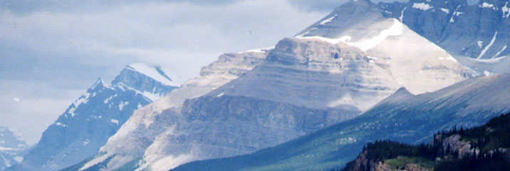
PHOTO
NOTES: All photos (except
the #4 - the bear) were taken by Bob Boonstra, July 27-30, 2000.
Photo 2 is of Jack Eason. Photo 5 is the author. Photos 3,
6, and 7
do not have a direct correlation to the text. The inclusion of
the bear photo, photo 4, is fanciful
- it is not Hubertus' bear. The photo was taken on the Rocky
Mt. 1200 route on the first year (1996) by Harold Bridge. |