| Newsletter - 2022 Archive |
Cycling Club |
 |
| Newsletter - 2022 Archive |
Cycling Club |
|
Next--->
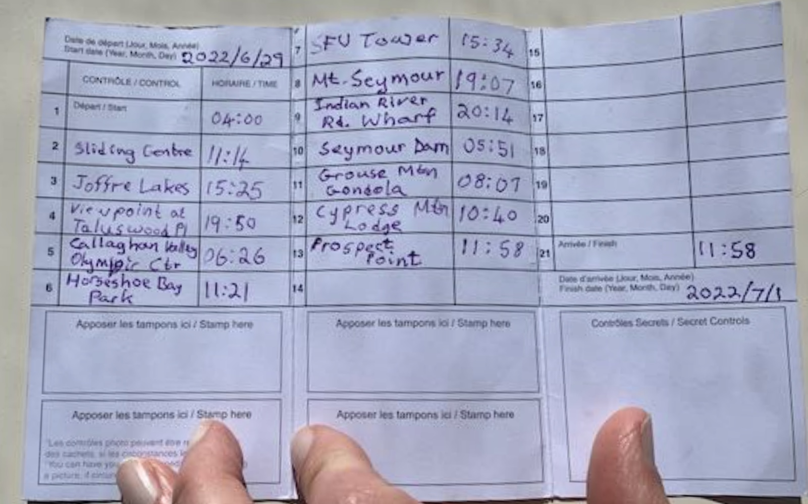
Sea to Skies SR600 Why? Planning Planning was difficult because I really did not have a good idea how fast I was going to be. Three of the climbs on the course were bigger than anything I had ever done before. They were each rated HC on Ride with GPS and Strava. "Hors catégorie" (HC) means "beyond categorization"! If I needed to do some city riding at night, that would be no problem, but the highways and the climbs needed to be in daylight. The (Final) Plan Day 1: 265 km, 4800 m 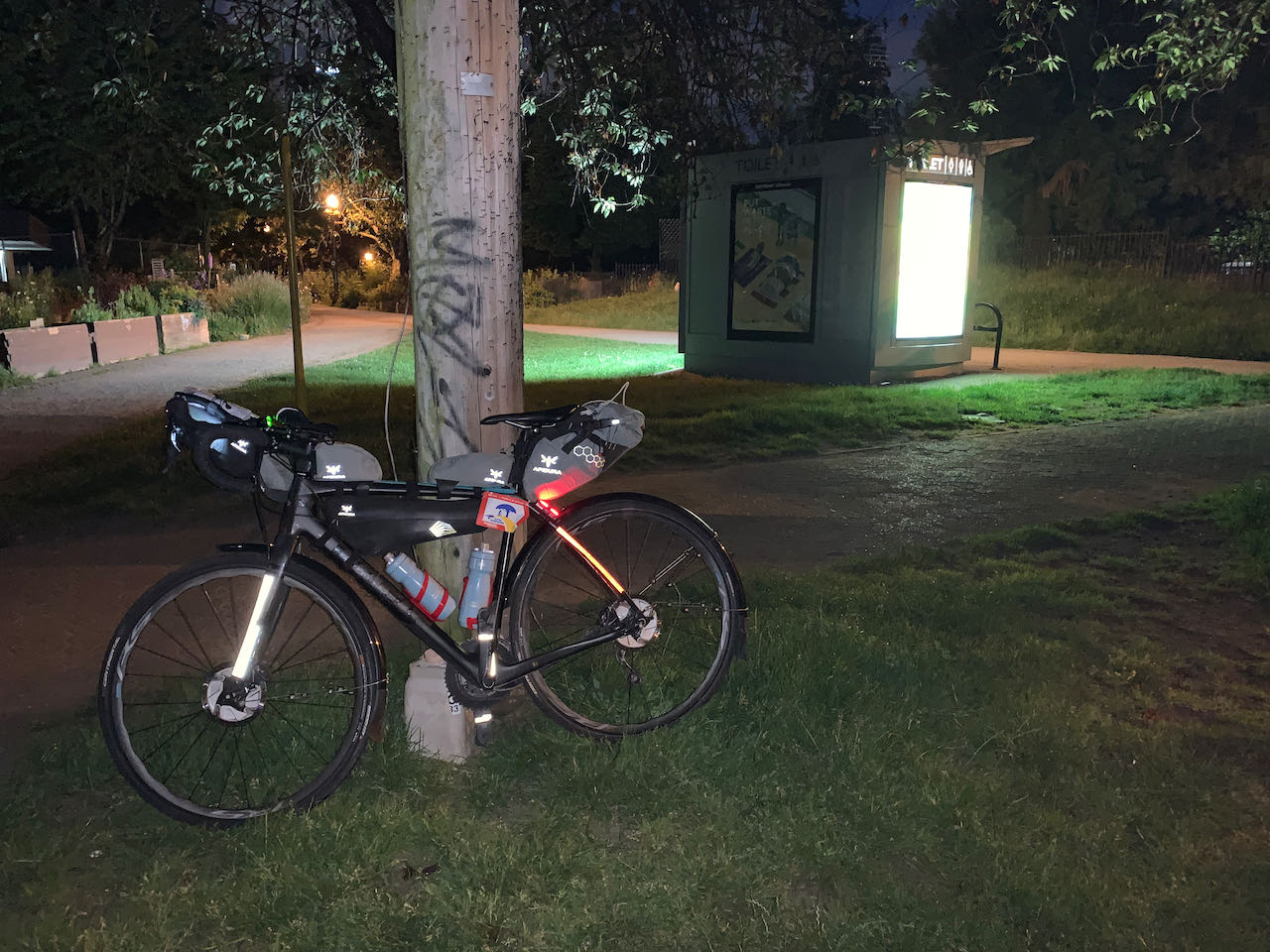
The Ride The Sea to Sky highway between Horseshoe Bay and Squamish is spectacularly beautiful, with the mountains rising straight out of the ocean. It's not flat but the grades are easy and the climbs are, mostly, short. There is a significant climb leaving Britannia Beach going north. The shoulders are narrow with a blind corner. I was happy to put it behind me. In comparison, the section from Squamish to Whistler is a bit dull. At any other time, it would be a beautiful ride the in the mountains but it pales in comparison to the Horseshoe Bay to Squamish section. It didn't help that traffic had increased. I stopped for a sandwich at Creekside Village. I only eat fast food during a Randonnée. I am on the clock, even on a Permanent. In this case it was the daylight clock that I was most concerned about. Before every ride, I copy the route sheet into a spreadsheet that predicts my time at every turn. Then I look at the map to see where I can get quick, healthy food. I plan my food breaks in advance. As long as I am on pace, I know exactly where I am going to stop for food and what I will eat. I highlight the line on the route sheet to remind myself of the location while I'm riding. I don't waste time looking for something and I always have a location that is on the route, and on the right side of the road. My lunch stops are frequently at a Subway. I can get a big sandwich that is fairly healthy and, most importantly, easy to digest. The sandwich even fits in my jersey pocket if I need to keep some for later. I avoid grocery stores unless I know the store and what they will have. At grocery stores it's too easy to waste time searching and deciding. 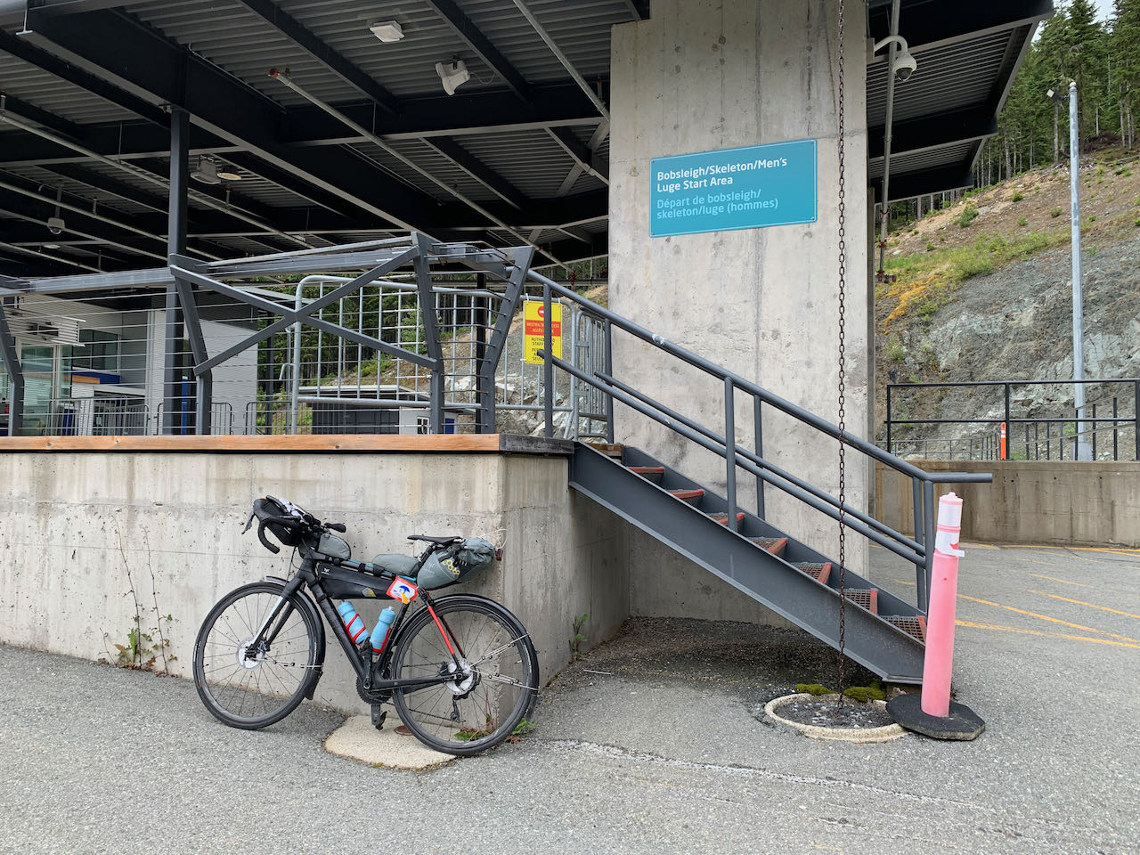
The first steep climb of the trip was the Sliding Centre at the top of the bobsleigh/luge track. The views over the valley were the reward for getting to the top. With that out of the way, I was ready for the downhill to Pemberton. I made a quick stop in Pemberton to refill my water bottles. I typically get Gatorade or PowerAde, especially when I need an energy boost. And I needed all the energy I could get for the next section. Starting at the shores of Lillooet Lake, the first and biggest HC climb of the trip was over 1000 m of unrelenting climbing. It was by far the biggest hill I had ever climbed, despite the fact that I have criss-crossed the Rockies several times. And that's where I ran into the forecast showers. I had light rain and drizzle for the entire climb. At first it was a good thing, it helped keep me cool while I worked my way up the hill. As I got higher, it started getting cooler and cooler. Halfway up, I stopped to take a photo of a waterfall. The raging creek was creating its own pocket of frigid air. It was time to layer up. 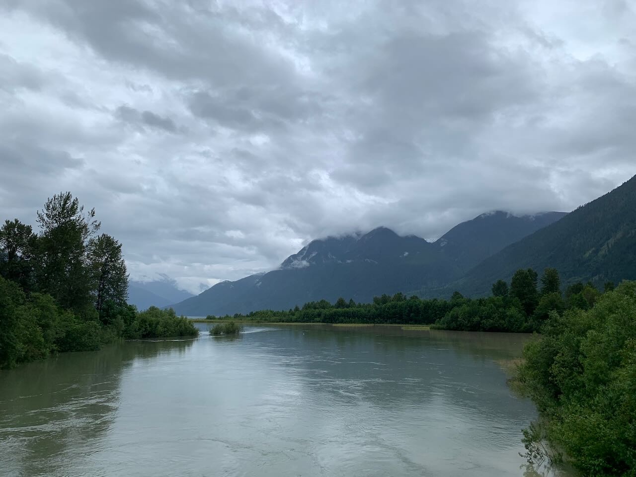
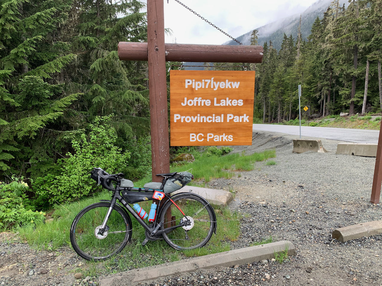
I have never been to Joffre Lakes. From the photos I have seen, it looks breathtaking. Alas, I saw none of it. Yes, I made it to the top but from the parking lot entrance, there was nothing to see but grey sky and trees. It gives me a reason to return when I'm not on the clock. I took the mandatory control picture and added more layers for the long descent. In the Super Randonnées, the proof that you arrived at each control is a prescribed photograph of your bicycle, with its frame badge at the location. Prior to leaving, I had printed the required photos for each control so that I always knew that I was taking the picture the way the organizer intended. Needless to say, the descent was fast. I was focused on nothing but the road as I plunged down the 13 km long hill. It wasn't until later that I learned that my average speed was close to 50 km/hr with a peak of 68. It was intense and exhausting. And it was over in 15 minutes. Thankfully the rain had stopped because at those speeds, raindrops would have been painful. I had planned to place my dinner order when I was about 30 minutes from Pemberton. That way I could have a hot meal without the wait. The mosquitoes had different plans. Whenever I stopped, they attacked. Whatever time I was going to save by calling ahead wasn't worth it. I stopped at Backcountry Pizza for dinner. I still had a lot of climbing to get back up to Whistler but it was nice to take a break. The pizza was delicious, and I ate the whole thing. 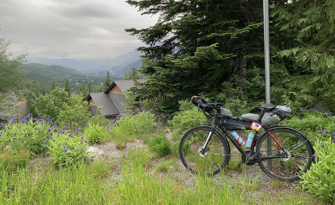
The final climb to the last control of the day had some pitches that seemed very steep. I pushed my bike over one of the steepest sections. In hindsight, I don't believe it was that steep, it was a long day and my legs were done. It was still daylight when I reached my hotel. The Legends Hotel does not allow bicycles in their rooms but they provide a secure bike locker and a lock. I carry a "lunch lock" that weighs about 70 grams but it wouldn't deter a thief with wire cutters. Not having my bike in my room meant that I had to take everything off the bike that I would need for the night. It felt like a waste of time. Time that I would prefer to spend pedalling, eating or sleeping. Dawn arrived too soon. But it arrived anyway and I couldn't let the daylight go to waste. At that hour of the morning, there was nowhere to get breakfast so I brought some instant oatmeal to get me started. 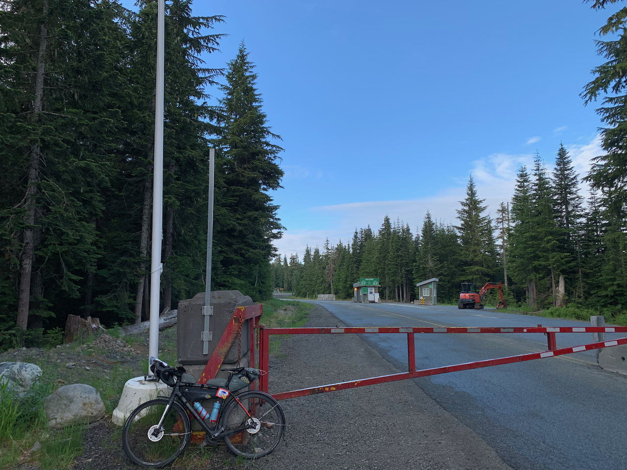
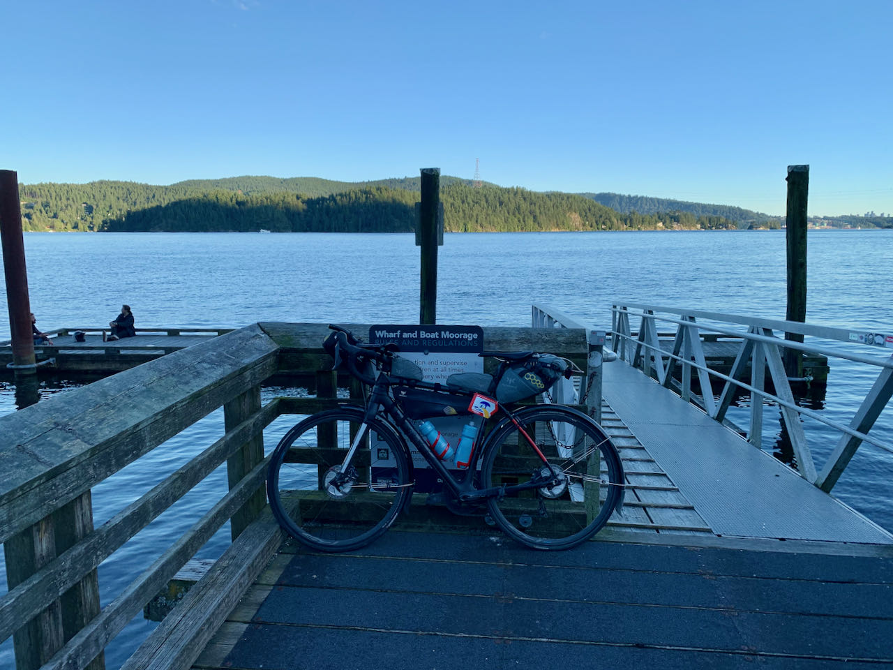
The first climb of the day started at sunrise. As climbs go, it was a fairly easy climb to the Whistler Olympic Centre in the Callaghan Valley. Prior to this ride, I hadn't known that this place existed. Somehow, I thought that the Nordic events were on the trails around Whistler Village. I guess if I had thought about it, I would have realized that there was no stadium or shooting range anywhere along those trails. It was summer and the gates were closed, so I didn't get to see the venue. I descended the valley under blue sky, looking at the rugged peaks of Black Tusk in front of me. I had planned to stop in Squamish for breakfast but I had been eating as I rode down the hill from Whistler. I still had enough water to get to Horseshoe Bay so I pressed on. The southbound ride on the Squamish to Horseshoe Bay section is even more spectacular than the northbound ride. As you pedal south, the Sound widens with channels around various islands like Anvil Island, Gambier Island and Bowen Island. In the distance, I could see the ferries that serve the islands and Sunshine Coast. Horseshoe Bay arrived sooner than I expected. It was warm and sunny when I reached the control. What should have been a lovely photo of my bicycle by the big propeller with ferries in the background ended up being a lovely photo of my bicycle by the big propeller with porta potties in the background. I'm sure the rebuilt park will be nice when it's done. I stopped for an early lunch at Starbucks before climbing back up to Marine Drive. Marine Drive is a fun winding ride past marinas, past gorgeous houses and along the shore of Burrard Inlet. Then it was across the Lion's Gate Bridge and onto Burnaby Mountain. The ride through the city was on bike paths, protected bike lanes, quiet roads and the Central Valley Greenway. It varied from manicured residential streets, parkland, industrial land and the land beneath the elevated SkyTrain tracks. 
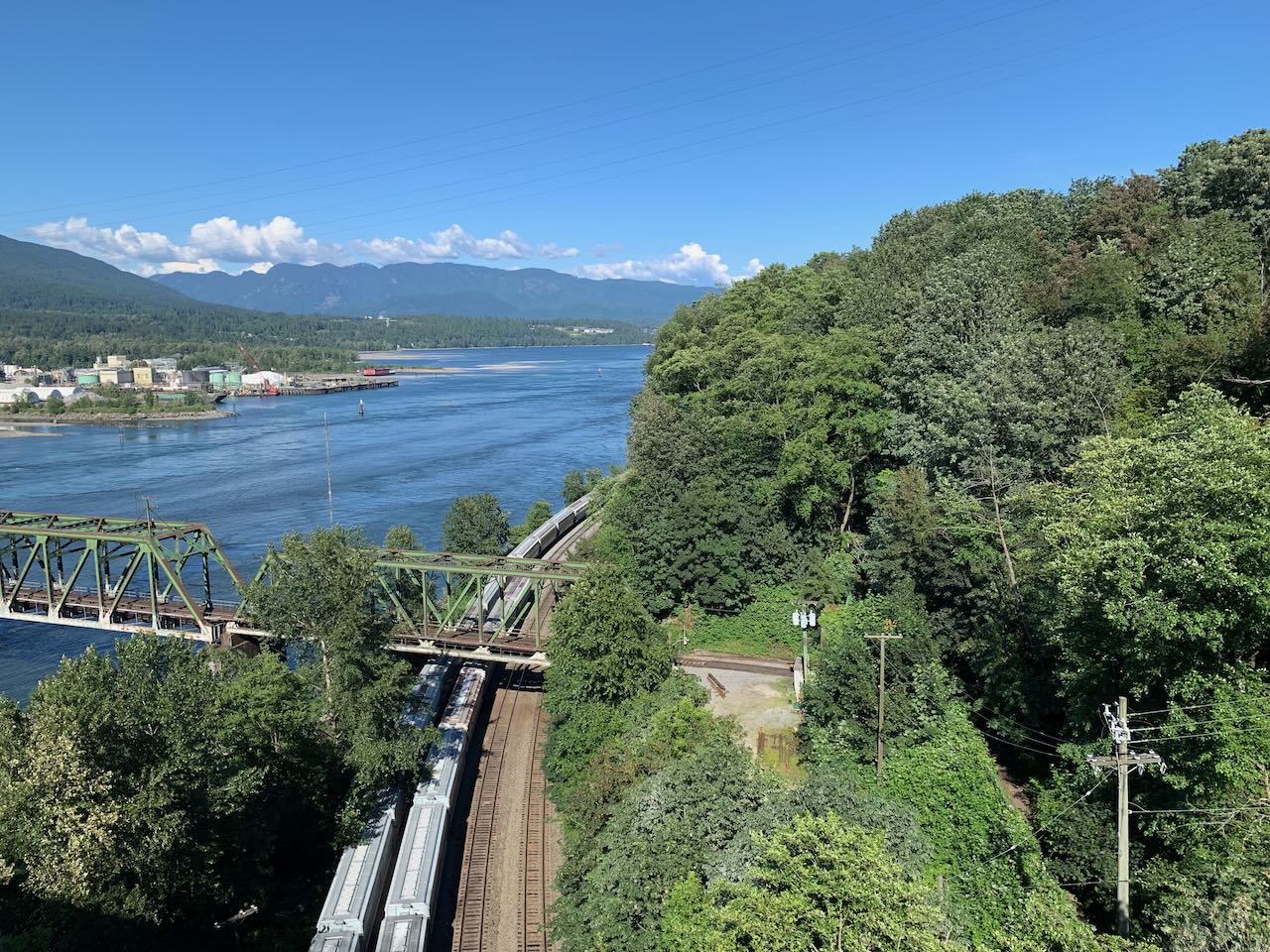
The climb up and down Burnaby Mountain takes you right around the mountain. On one side you can see across the Fraser Valley. The big suspension bridges stand out tall and clear in the distance. On the other side of the mountains there are glimpses of the working harbour. I stopped at Tim Hortons at the top for a late, second lunch. There were some busy streets with steep climbs and even steeper descents to get through Port Moody to the Barnet Highway. I was climbing a hill when my GPS said I was off course. Did I miss turning at the last intersection? I pulled off the road at the first available turnoff. It turns out that this is exactly what the route sheet said to do. Turn off the road and go back on the sidewalk to the Trans Canada Trail. I was happy that I didn't have to go back down the hill. I was even happier to be on a peaceful trail with parks and forests. I followed the route rigorously because I had no idea where I was until I reached the Iron Workers Memorial Bridge. I stopped to take photos on the bridge and then got ready for the day's big climb. It was not without some trepidation that I faced the climb up Mt. Seymour. It was late in the day; I had already ridden 200 km with more than 3000 m of ascent. And that was just today - never mind that I had done much more yesterday. There was a steady stream of cyclists going up and down Mt Seymour. A few of them passed me. One rode with me for a while. We had a nice chat. I, on the other hand, passed no-one. Every kilometer was marked with a signpost telling me how far and how high I had ridden. At first they were demoralizing - I had so far to go and so much to climb - but as I got closer to the top, they were motivating. Only 3k to go, then 2 then 1... I had made it up the hill. In the winter, ski hills look so pristine. The chairs dangle from the cables like Christmas ornaments, the snow cover glistens in the sun. In summertime they look a bit run down, the lift chairs are stacked in untidy heaps and ground is a field of lifeless gravel. Usually when you drive up to a ski hill, you arrive at the bottom of the lifts. But the required photo was the top of a chair lift. Wouldn't it have been cheaper to build the road to the bottom of the lift? The descent seemed even faster and more exhausting than the one from Joffre Lakes. I was so focused on the road that I didn't know how cold I was getting. When I stopped at the bottom, I was shivering and lightheaded. I know the lightheaded feeling. It means I have run out of gas. Well technically it means that my blood sugar levels are seriously depleted. I practically inhaled a Cliff Bar and some Gatorade before continuing. The ride along Indian River Road was through a majestic, old growth forest. A group of men on one-wheel electric scooters whizzed by me. The descent to the Indian River Road Wharf was alarmingly steep. I was wondering if I was going to have to push my bike back up! I stopped and chatted with the scooter riders on the wharf before facing the uphill. I was determined to make it up the steepest grades without getting off my bike. I was nearly successful. I lost momentum just short of the top of one of the steepest pitches. There was no way to recover without getting off and pushing. You would think that after all that climbing and all those miles that I would sleep well. I didn't. Despite being exhausted, I couldn't switch off. I was aching and uncomfortable. I was too hot then I was too cold. I was constantly thirsty and drank more than a litre of water. And then it was dawn and I was back on the road. I was all alone in the early morning light riding towards Seymour Dam. It was cool, calm and clear. I was content even though I hadn't slept. All that water I had consumed during the night meant several unplanned stops along the way. It was a good thing that there was no-one else around! My last chance for food and water was along Marine Dr. After that, I had to complete the day's climbs before I would find another place to fill up. I stopped at McDonalds, had breakfast and topped up my water. The first climb was to Grouse Mountain but that was just the warmup. I took the required photo at the entrance to the gondola then rode the short descent to the Cleveland Dam. 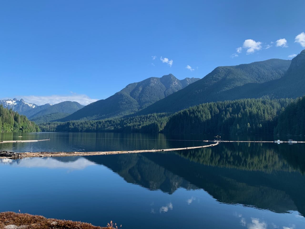
After the dam, the route continued through the forest on the Baden Powell trail. The path was steep, rough gravel. I didn't have the confidence to complete the hill on skinny tires so I got off and pushed. I emerged from the forest onto residential streets high in the hills of North Vancouver. It was pleasant easy riding before the intensity of Cypress Mountain. It was warm and sunny. It was Canada Day. This was it. All I needed to do was get to the top. There were hundreds of cyclists going up and down the mountain. I was the only one with bags. I pride myself on always traveling light but here I was climbing a mountain with everything I needed for a multi-day unsupported ride. I started to think about what I was carrying that I didn't need. Just like Mount Seymour, there were milestone markers giving elevation and distance at each kilometer. The only problem was, I had only a rough idea of how long the road was and what the final elevation would be. I'm an engineer and I often occupy my mind on a difficult ride with mental arithmetic but in this case, I was missing part of the equation. At the end of the first switchback, I stopped at the Cypress Lookout to take a photo of downtown Vancouver and Stanley Park far below. It felt like I had been climbing forever but I was only about one third of the way up. 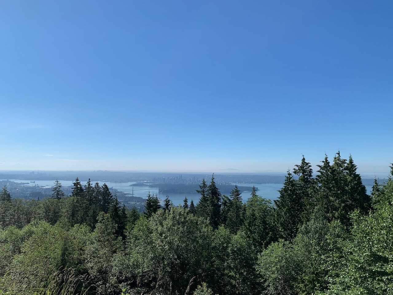
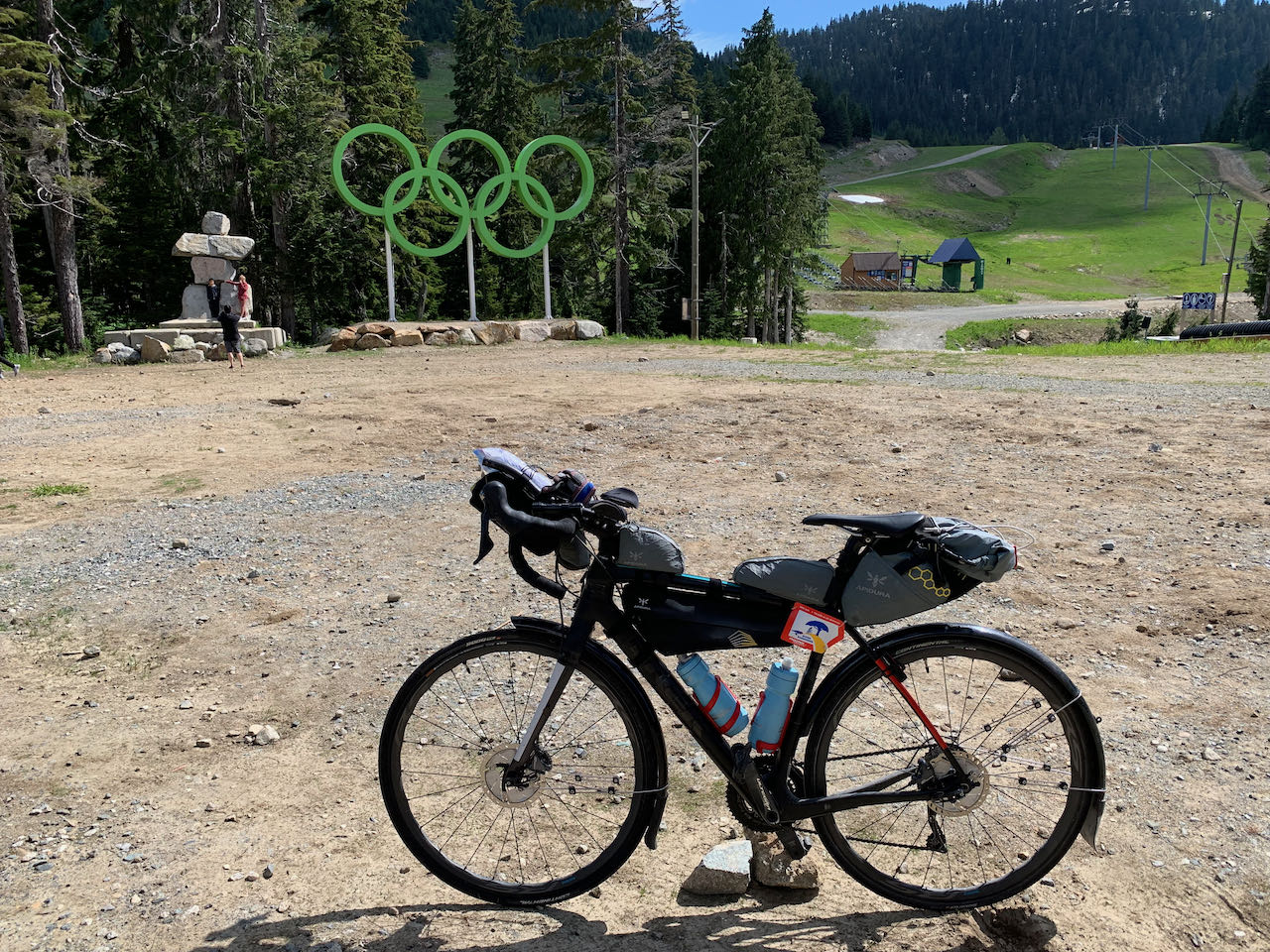
I pedaled and pedaled. Sometimes standing, sometimes sitting. And then I was at the top. I did it! There was nothing left but a long descent to the finish. I lingered at the top, ate some food, drank some water and took the control photo. I stood my bike up by putting a rock under the pedal then took the picture with my bike in the foreground and the Olympic rings and an inuksuk in the background. One of the many cyclists at the top said that it was a cool shot and did the same. As I got ready for the descent, I felt a bit better about the Randonneuring bags I had carried up the mountain. The other cyclists were facing a frigid descent in shorts and tee shirts. I happily put on my long-sleeved jersey, full finger gloves and a windbreaker. I should have taken a picture at the top of 22nd Street. It was like looking down a giant ski jump - a long steep ramp that leveled off towards the bottom. Only this ramp was over a kilometer long. It might have been a fast descent but there were plenty of intersections and stop signs to keep my speed in check. 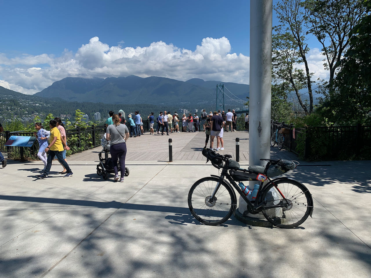
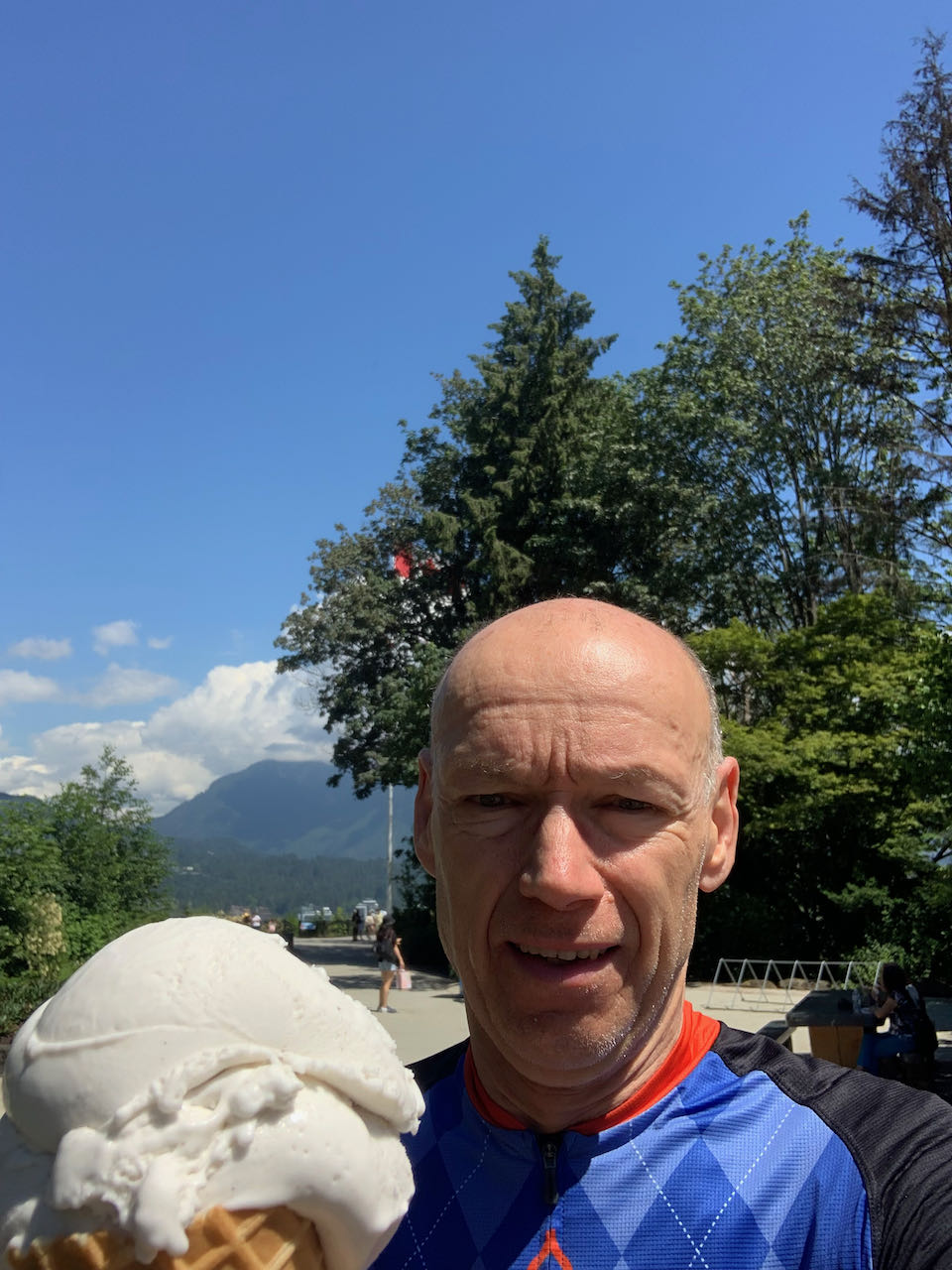
I coasted down the Lion's Gate Bridge for the last time and suddenly it was over. I was at the Prospect Point Lookout in Stanley Park. Time for an ice cream! 609 km with 10880 m of climbing in 55 hours, 58 minutes. Yes, I can. 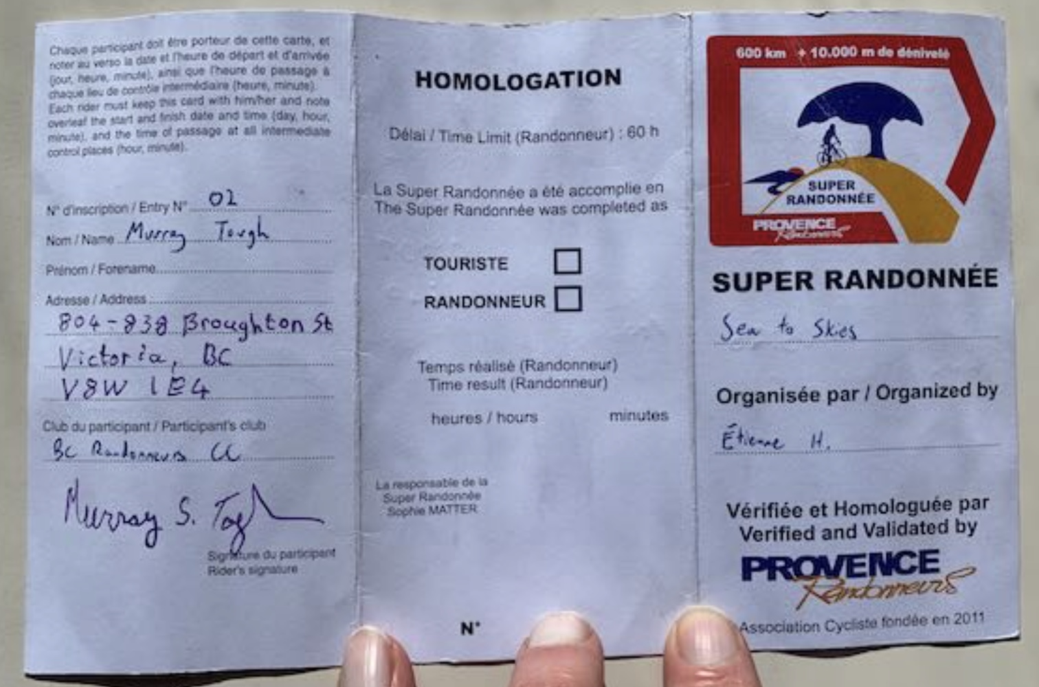
Go to: BC Randonneurs Randonneur 10,000 Page Go to: Audax Club Parisien's Randonneur 10,000 Page July 12, 2022 |