| Newsletter - 2017 Archive |
 |
Cycling Club |
 |
| Newsletter - 2017 Archive |
 |
Cycling Club |
 |
Next--->
|
When the Hallucinations Start I first heard of the Crowsnest 1000 during the group breakfast at the end of the Seattle Randonneurs Fleche Northwest in 2017. The organizer, John Pearch from Olympia, WA, had led in another of the teams, and he mentioned something about doing a 1,000-km ride later that year. I met him again when I rode the 600-km brevet around the Olympic Peninsula. I had always wanted to do a ride around this section of Washington; I had always thought of it as being really desolate, full of lumbering logging trucks and dense fog. Instead, it was quite a nice ride with lots of sun, too many pickup trucks pulling boat trailers, lots of hills, and some cold and lonely stretches along the Hood Canal. When I finished that ride, John handed me a beer in the empty parking lot of the pub in Olympia where I finished that morning. I had ridden straight through and managed to avoid most of the later boat-hauling traffic that plagued those who opted to motel it in Port Angeles. He asked me again if I was confirmed for the 1,000. By then, I knew that the route started in Mount Vernon, crossed over the Cascades on Highway 20, then cut north onto Highway 97 to Osoyoos. It then crossed the Monashees and Selkirks in BC before returning to the US at the Idaho panhandle, then curved around western Montana before ending in the skiing mecca of Whitefish. I told John that I loved the idea of a one-way route, and especially of riding into places I'd never ridden – the mountainous sections of southern BC, and two sparsely-populated US states. I had recently bought a carbon fiber Calfee with titanium couplers, and I was anxious to take it on the most challenging paved terrain. Leading up to this ride, I had shaken down the Calfee on the aforementioned Olympic Peninsula 600, as well as a couple of brevets around Richland, WA, and one near Eugene, OR. Did I mention I like to ride on strange roads? I had also honed the bike further on the 1200-km blast furnace called the Gold Rush Randonnee in California, where I survived buffeting hot winds while the GPS showed temperatures of 46 deg C on the descent into Oroville. I had far more confidence in this bike than in my previous geared steel frame, which appeared to me to have alignment issues and would go into a speed wobble on fast descents with crosswinds. The Calfee was rock-solid at high-speed, but could be a handful on low-speed (less than 9 kmh) climbs when I was tired, but this could be a problem with any bike. In the month leading up to the Crowsnest, I'd spent a month in England, Scotland, France, and Spain riding LEL, the Raid Pyreneen, transport stages between Paris and the south of France and in the Massif Centrale, as well as the iconic Granite Anvil in Ontario. I may have been pushing it a little, as I developed a bad cough at the end of the Ontario trip, but I had a couple of weeks to recover before the Crowsnest. Even though I was feeling sick, the bike was handling fine, especially running wider 28mm tires at lower pressures, which enhanced the ride, the cornering, and the tires' longevity. The only bike issue was a recently overhauled Campag 10-speed Ergopower shifter, which I was using with a 9-speed Shimano cassette (it works great). I had recently replaced the internal springs, but shifting to larger cogs would sometimes result in some slipping during the shift. I didn't have time to deal with this, and the shifting was still fine otherwise, so I just let this go, and it never became a problem. For the Crowsnest, I used wheels with straight-pull spokes: a Ksyrium on the rear with 20 spokes, and a disc brake front wheel I had recently built with 24 straight-pull spokes, a Hope hub, and a Chinese carbon fiber rim. I had already put 1,000 km on this front wheel, so I had enough confidence that it would not fail. I wanted to see if I could get away with 24 straight-pull spokes on a wheel with a disc brake, as I had found that 28 spokes on a normal front hub had not been a problem. The rear wheel uses a rim brake because it's far lighter than a disc brake caliper and rotor, it's far easier to pack with a coupled bike, and because I don't ride enough gravel roads. There's no need for a rear disc brake on paved roads. In fact, with the front disc, I hardly ever use the rear brake anymore. Maybe on wet descents. 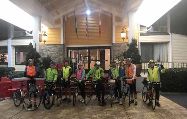
The eight of us who had signed on started in darkness from the hotel in Mount Vernon on roads familiar to me. Mick, Nigel, and Kuan took off early and built a big lead. The rest of us, including Mark from California, locals Bob and Thai, and Jan, the only female, rode a steady pace line, taking 15- to 30-minute pulls along the empty South Skagit Highway. After the road started to become hilly past Concrete on Highway 20, we caught Kuan, who had thought better of matching Mick and Nigel's aggressive tempo, especially with some major climbs approaching. 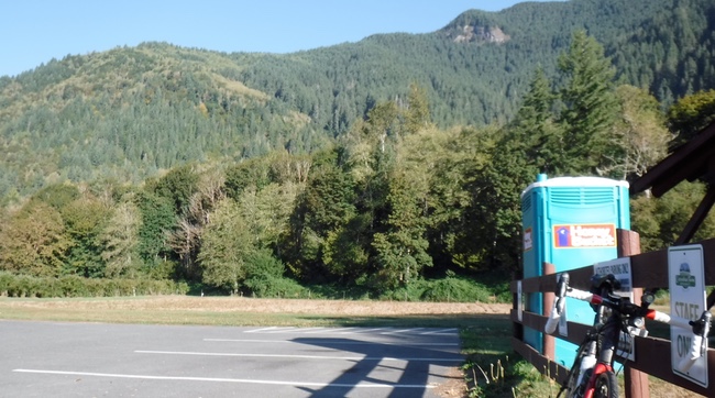
I dropped back at a convenient port-a-pottie but caught up at the foot of the Rainy Pass climb and kept going. I had found that spinning smaller gears faster had got me up the Pyrenees far faster and more easily than pushing even medium-size gears, so I had the compact cranks (50/34) with the 11-32 rear cassette and had no problem dropping it into the 28 as soon as things started to slow down. When my lower back or butt got sore, I could pop it up a couple of cogs and use my body weight to drive the cranks, just as I had on the fixie. This would also be a good way to keep warm later, as mountain passes at over 1,000 meters tend to get pretty cold at night. 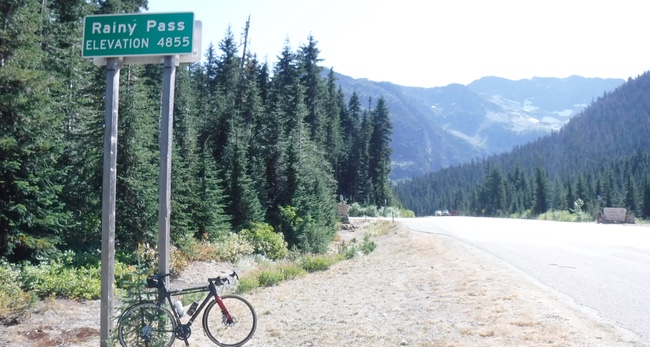
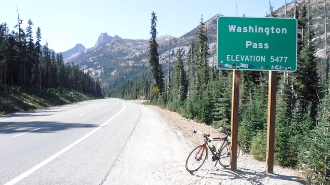
I rode by myself and took pictures at the top of Rainy Pass and Washington Pass, flying down the wide switchback below Washington Pass and remembering having to go the other way on last year's Cascade 1200. I stopped for a hot dog in Winthrop and continued to Twisp, where the long climb up Loup Loup Pass begins. The organizers had water about five km from the top of the pass, and it was starting to get dark, so I put on the rain jacket and zipped it all the way up in anticipation of a cold descent to Okanogan. Although only five kilometers, the remainder of the climb took about a half hour at 10 kmh. It was biting cold at the top, but there was enough light for a photo before the descent. 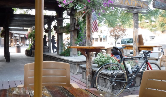 Winthrop, WA 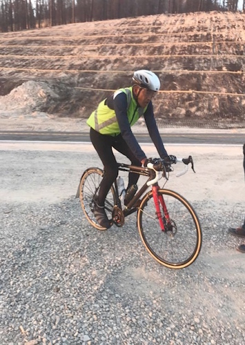 5 km from Loup Loup summit Now that we were across the Cascades and into central Washington, it actually got warmer the further down I rode. At Omak I stopped for more solid food, as this seems to work far better for me than "sports nutrition." The energy bars and gels become less and less interesting the more I eat them. I used to like Honey Stinger Waffles, but now I don't care as much for them. I would become ill if I were to even see a container of Ensure. The first day of riding ended in Osoyoos at around 12:40 am for me, which seems long, but fits into my personal rule of thumb for ETA: Figure on a 25 kmh average speed, but add one hour for every 1000 meters of climbing. We rode 380 km and climbed 3000 meters, so that's a little over 15 hours plus another 3 hours for the climbing. We started at 6 am, so should finish at around 12:40, provided we don't take either long stops or many short stops. So far, so good, but after dinner and a shower, I didn't get into bed until after 2 am, and I was up at around 5. Not good, and my rule of thumb breaks down completely when I become too tired. Day 2 was the heavy-lifting portion of the journey. Right out of Osoyoos, we started the long climb of Anarchist Mountain. The climb doesn't end where it flattens at the top of the mountain outside Osoyoos. It's flat for a ways, then it climbs more. And this repeats a few times. I felt really tired on the climb, so I watched Jan and Bob disappear up ahead. Finally, about 30 km from the start, you see the Anarchist Summit sign. This is followed by a fast descent and another climb to Eholt Summit. There is a flat section around Grand Forks, where I| stopped at a Subway for lunch without seeing any of the other riders, and then the road climbs and climbs to Bonanza Pass (signed as Paulson Pass) before descending to Castlegar. From Castlegar, I couldn't believe there was still another climb before you got to Salmo, and all of these climbs were well above 1,000 meters. The climb before Salmo is called Bombi Summit, and it just keeps going up and up. By the time I reached the top, it was dark, and I was getting very tired. I rolled down the fast descent, and the closer I got to Salmo, the more I decided I'd had enough. It would be 10 pm by the time I reached Salmo, and I still had the 1700-meter Kootenay Pass to go over, the highest pass on the journey. I had a motel reservation for the next night in Whitefish, and a train ticket to Seattle for the day after, so I just needed to get some sleep in Salmo, and head directly to Whitefish the next day by a route that involved minimal climbing. This would mean crossing back into Washington, getting to Sandpoint, ID, then going north to join back with the official route north of Bonner's Ferry. I casually rolled into Salmo about five minutes before the Subway closed. After a small dinner, I went looking for a motel. The first two were full, so I rode another 2 km to the last remaining motel, which I remembered as having a Vacancy sign lit. But when I got there, the sign on the darkened office door said that the office was closed and the manager would be back at 6:30! I pulled out my phone and I called John to advise him of my plan. He told me to stay put, as he had another volunteer making sure we were all safe on the roads. Very shortly, Pat Leahy pulled up in the motel parking lot in his well-stocked Subaru. "I think I've had enough. I'm pulling out. I won't make Creston until past 3 am, it'll be a heck of a cold descent, and I'm not having any fun out here." "Well, that would be silly," he replied. "You're currently the third rider on the road. I just went past four riders who are behind you. They should be passing here shortly, so you'll have people to ride with. Besides, I've got some warm clothes in the car you can use. Would you like some hot soup and coffee?" With that, Pat fired up the gas stove and boiled up enough water for a cup-a-noodles and a cup of coffee. This was enough to get me going. I wrapped a large towel around my neck like a scarf, and I set off after Jan, Bob, and Thai, who had stopped but had decided they wanted to keep moving. I caught them as they were stopped at a rest area, and we started the climb of Kootenay Pass together. About 10 km from the summit, Pat was there with hot tea and noodles. By now, I was getting really tired, so I let the other three continue while I crawled up the climb. Kuan caught us, and he passed me as I walked up one section of the climb. The summit took forever to reach, and by then everyone had disappeared. 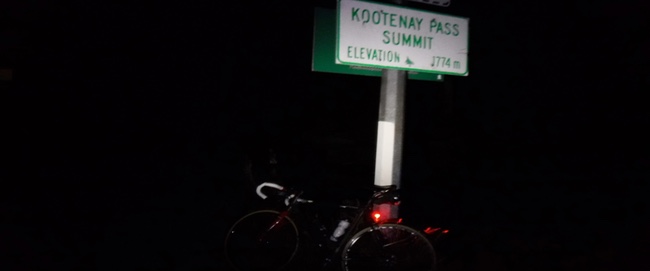
I don't remember how I got down the descent, but before it levelled off, I was shaking uncontrollably from the frigid conditions. My GPS was showing 0 deg C, and I learned later that the temperatures had gone down to minus 4. Fortunately, we at least missed the snow that would fall the next day. I stopped again, figuring it was unsafe to continue. With frozen fingers, I pulled out my phone and dialled John. "No network available." OK, I'll roll down further and try again. A few hundred meters later, same thing. Roll slowly to a rest area. Same message. And the rest area just had port-a-potties, no heated brick and mortar, otherwise I would have just slept there! So I kept coasting, pedaling slowly, or walking for the next hour. Soon, another rider, I forget who, rolled by. I asked him to let them know in Creston that I needed a ride in. He said he would, but that it would likely take another hour before anyone arrived. I said that was OK. It was around 4:30 am by now, and I was becoming sleepy and disoriented. The road, illuminated by my small battery-powered LED headlight, was no longer looking like a road. It was more like a driveway or a parking lot. The middle lane stripe no longer held any meaning, and the fog line was indistinguishable from a curb. I decided I needed some sleep, so I rode to the edge of the road and crashed the bike trying to get off. I sat and put my head down and woke up a few minutes later, somewhat refreshed. I continued coasting, then pedaling hard out of the saddle, then walking again over the next hour. Eventually, as it became lighter, I could sense that it was no longer as cold, and I could ride a bit longer before the shivering started. Pat's car finally arrived, and he told me I was only about 16 km from the motel in Creston. This seemed doable, especially after he had me sit in his Subaru with the fans blasting full heat! 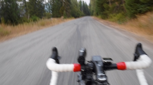 Forest service road With that bit of augmented warmth, I was able to ride into Creston, arriving at around 7 am. I remembered from riding the Cascade 1200 the times when I'd be leaving an overnight control after a decent night's sleep at about this time, and riders would still be just coming into the control, and I would wonder how they could keep going when they were so close to the control closing! Well, live and learn. As you get older, you get to experience just about everything you'd wondered about. The best part of the ride now was being able to get into the warm motel room and running a hot bath. I filled the tub with water as hot as I could stand, and just lay there for the next half hour. Even though inadvisable, I slept in the tub for about half that time. I then set my phone alarm for 9:15 and slept under the covers for the next 45 minutes. After getting into fresh shorts, I enjoyed the full hot breakfast provided by the motel, and finally left at around 10:15 for the final 200 km to Whitefish. I only needed to get there by 9 am the next morning, and there were no further 1700-meter passes to go over, so I figured I was safe. With Mark from California out as a result of his knee injuries being aggravated on Paulson Pass, I was now the 7th and last rider on the road, and I was at least a couple of hours behind, but that didn't bother me at all; I knew I just needed to finish, and there was no question I'd be in before the cutoff. However, just to be on the safe side, I phoned my motel in Whitefish to let them know I'd likely be in after midnight. "That's OK," they said. "We'll put your keys in an envelope and just tape it to the door of the office. You'll be able to go around the back to get in." I just love these small communities where people are still so honest. After getting to Libby, MT, where I stopped for a Big Mac at the McD's to have my card signed, the route turned away from Highway 2 and onto the forest service roads for the next 60 km. The big problem with the forest service roads, especially over such a significant distance, is that they all look the same. The same features – the plants on the side of the road, the roadside barriers, the bridge rails – all keep repeating over and over. And as the shadows lengthened, and the afternoon turned chilly, the twilight brought more tiredness as the light faded. Soon, I was riding in darkness with just the pool of light illunimating the road ahead. For long stretches, it looked like sand or snow had been spread over the road, and I began to wonder if I should have even been out on such a road surface. At odd intervals, as reason and good sense left me, I found myself turned around. I looked at the GPS and didn't see any tracks to follow. I turned the bike around, and the tracks were there! I wondered what I was doing there, and if I even belonged on this road. Nothing else seemed to be on this road; no cars had passed for ages in either direction. I would stop and sleep for five minutes at a time, being careful to stay right on the shoulder. Once I found a bridge guard rail I could sit on. Waking from a short sleep did help. At certain moments, I could convince myself that all I needed to do was to follow the GPS and I'd be fine. But at other times I didn't understand what the game was, what I was trying to accomplish, and why I had to do it on a bicycle! I thought I was gong around in circles and I'd never be able to get off the forest service roads. Eventually, I encountered John and Pat coming the other way in their SUV. They had been out looking for me, and they were able to reassure me that I was still on course, I wasn't too far behind the others, and that I had not been going in circles. I was only about 8 km from the top of the climb at Happy's Roadhouse, and I'd be back on a busier Highway 2 shortly. Thus notified, I continued the ride, even as the rain started. Things didn't get much better on Highway 2. I was expecting a good, long descent, but the road just kept climbing, the same grade as a long overpass. It was pitch-black, and the odd car or truck with high beams would rush by. Doubts about the route are usually one of the first manifestations of hallucinating, and I found myself stopping a few times to question the route. On a dark road, I also usually see an upper deck above me, as if the road is a double-decker bridge, and it's hard to convince myself that there's nothing there. I finally reached McGregor Lake and the road did start to descend. I was still not sure if I was headed in the right direction. However, as the rain started to fall more seriously, I found I was finally nearing Kalispell, where the route called for us to get on the bikepath. With the low volume of traffic, the poor visibility on unlit bike paths, and the more direct route provided by the roads, it made far more sense to stay on the main highway. The GPS seemed to share this idea, as the track reappeared on the highway after disappearing towards Kila on a very questionable-looking broken path. I wasn't sure where either the ride hotel or my own hotel were located in Whitefish, so I started looking from about 8 km out. I was on Highway 93A as I crossed Hwy 93, but I saw Jan and Bob through the rain, waiting at the intersection - but from my right - for the light to change. My GPS quickly beeped to indicate a wrong turn – I was supposed to turn left, the same direction that Jan and Bob were traveling. I turned and caught up with the two, who had somehow got lost following the bike paths. The final kick into Whitefish was a long, dark, four-lane highway with flooded tire depressions and wide rumblestrips, but at least it was flat. We finally arrived at the finishing hotel control a little before 5 am PDT, so it was nearly 6 am local time, but well before the deadline. I had a small bite to eat before Pat gave me a ride to my motel. The guy at the front desk was very gracious, giving me a very late checkout, so I was able to shower and sleep until 11:45 am, and check out at 12:30 local time. It was still raining when I left the hotel to find some food and to wait for the 9 pm train back to Seattle. The big takeaway from this is that it's quite strange how we are often successful in spite of ourselves. We may want to quit, but it usually turns out that it would take far longer to find a ride back home than it would take to just finish the ride. I was ready to throw in the towel three times, but twice I wasn't able to make the call to get picked up, and the third time I couldn't find a vacant motel room. It would have been a lot easier and faster to just buck up and keep slogging. This makes you look real tough, real hard. But I sure wasn't tough.I just had to deal with the options presented and choose the one that made the most sense. And that's what led to another successful completion.
Go to: SIR's Crowsnest 1000 event page November 5, 2017 |