| Newsletter - 2017 Archive |
|
Cycling Club |
 |
| Newsletter - 2017 Archive |
|
Cycling Club |
|
Next--->
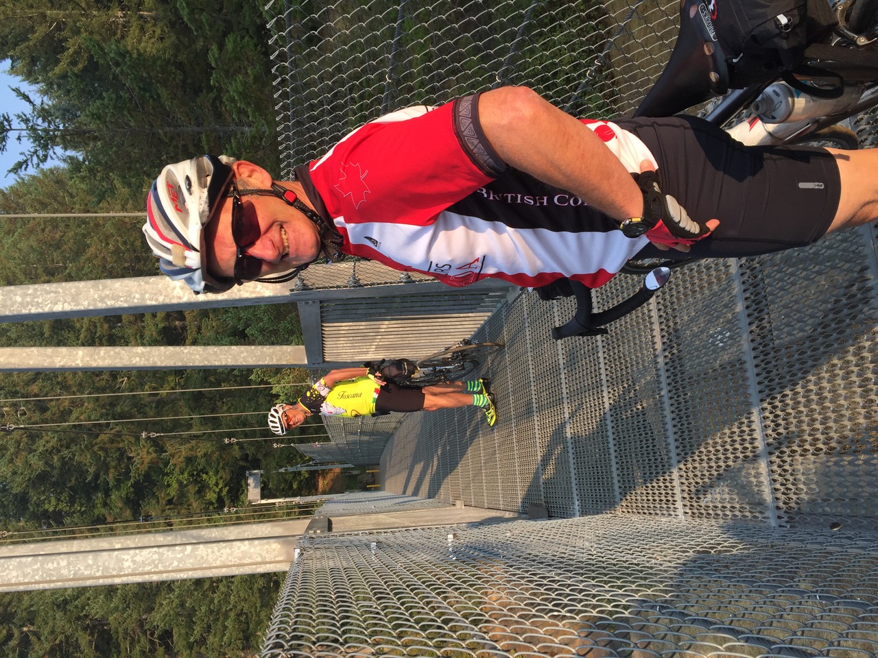
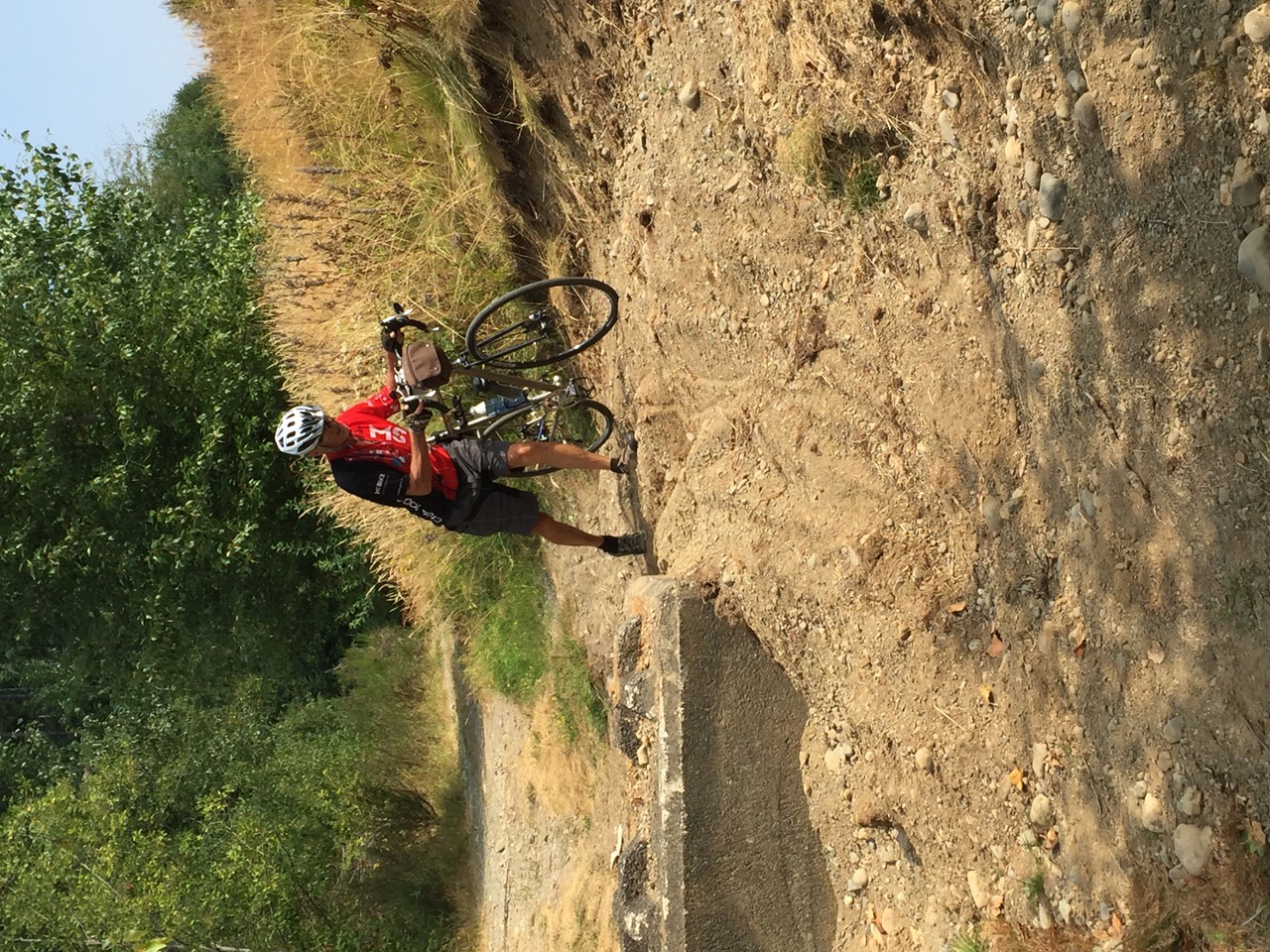
 Photos: Eric Byres Coombs & Cumberland Explorer After the ice and snow of last winter, I decided it was time to resurrect my BC12 pin ambitions. I managed the Kamloops 200 in April, then, whoops, somehow missed May, continued with P2P 200 in June, Pacific Shorelines 200 (P37) in July, so it was time for an August ride. Some riders with SlowSpokes, an informal cycling group in Nanaimo, had also expressed interest in a casual 200, so I made plans to ride the CCE (Coombs & Cumberland Explorer) on August 2nd. From this idea, 2 old members renewed their membership, and 2 new members joined. Well, air quality conspired against us, and we chose to not ride on the first really smoky day on Vancouver Island. We decided to reschedule for Friday 11 Aug, and while not everyone in the original group could make the ride, we picked up another new member to ride with us. By the time Friday rolled around, the air quality had improved, but was still hazy. We assembled at the coffee shop in Parksville, completed our paperwork, and prepared for a lovely day. 6 Crossing our first adventure, Top Bridge in Parksville, brought us to our main gravel stretch (about 400m) and our suspension footbridge. The air was crisp and all was promising to be a great ride. Next, we visited Englishman River Falls, our first control. The campground was just coming to life, and staff were preparing for the weekend onslaught. The light through the forest and the (limited by smoke) views over the fields were a joy. Riding through the back of Coombs and onto Little Qualicum Falls where are second planned adventure occurred, another 400m of gravel, across a footbridge over the river, and 400m more gravel to get back to pavement. The volume of water over the falls has diminished greatly over the last 6 weeks, but it is always a soothing sound as the river crashes into the pools below. Shortly after the park was our next control. It was here that Allen decided to ride a faster pace, and pushed on. We were to see him again much sooner than planned. 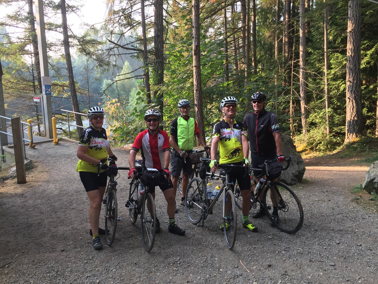
Once we were back to the old highway, it became a nice cruise up to Courtenay. Well, that was the plan. First we found Allen just finishing fixing a rear flat - pinch on a large subsidence on the downhill from Deep Bay. Allen rode with us again for a short while, and pushed on again. In Union Bay, we found Allen riding back towards us. "Big accident on the road ahead. Police say it will be completely closed for about 8 hours." The detour would be about 20km. "Police told me there is a short cut bicycles can use. Just go up McLeod and take the trail at the end onto the Inland Highway." So this is where the real exploration began: off route, an unknown road, and hours off course. No problem, it's a permanent. McLeod Rd in Union Bay heads away from the water, up hill. Not too steep. Until you turn the bend. 15%. OK, some of us walked the last 400m. While on the hill we watched the air ambulance trying to land on the highway. Our day was going We rejoined our route at the Cumberland exit from the highway, and immediately had another road closure - construction. "It will be closed about 15 minutes. Yes, you can detour that way..." So we took the 1km detour into Cumberland. Here, Carol decided that enough was enough, and went off to eat and cool down. The cooler temperatures were now at 33degC, and we still didn't know how to get home as the accident scene would be in place for several more hours. At our control at Comox Lake, we watched swimmers and boaters enjoying the sun, and I calculated we had 15 lost kilometres to make up, and would probably lose about another 5 by taking the Inland Highway to south of the accident. Carol decided to just ride back to the start, and the rest of us headed down into Courtenay to ride as much of the missed route as possible to make up the missing distance. Allen rode ahead, and 4 of us stayed together. Down into Royston, up to Courtenay, along the estuary on the trail, back up the hill to the Inland Highway, south to Buckley Bay and our next control. A quick stop for Coke. And to take off our sunglasses - it was getting dark. Wait, does that car have it's wipers on? Remember the coat? Left in the van? Yes, motorists promised us torrential rain just to the south. And no coat. The first drops struck as we left the control. But that was it! However, we had very wet roads, and of course, no fenders, so it rained mud for 3km. Then the road dried out and we were back to normal. Until my front flat going uphill. Looked like a rose bush clipping - a thorn through the tire holding the branch into a revolving thwup, thwup, thwup. Yes, I just had to pull it out. Pssst. Wait, it's gone silent. So I rode for another 3km to catch up to the rest before changing the tube. We enjoyed a quick stop at the Shell in Qualicum Beach to pick up fluids, and then a quiet easy ride on the Qualicum-Parksville bike route back to the finish. I stopped the clock at 205km (original route was 202km) but we actually had to ride 209km to get back to the cars. Not my best time, and significantly slower than planned, but with all the exploration, satisfactory. Oh, and Allen did manage to finish a couple of hours earlier than we 4 remaining. Carol had a nice 180km ride that involved a one hour ice-cream stop during the rain. We had fun, we finished 200km within the times, we just couldn't follow the pre-planned route in its entirety. But next month maybe I'll try a brevet. Special note to Eric Byres and Keith Gaunt for their first 200km ride. And thanks to Eric for the photos.
Go to: Permanent Results August 19, 2017 |