| Newsletter - 2018 Archive |
|
Cycling Club |
 |
| Newsletter - 2018 Archive |
|
Cycling Club |
|
Next--->
|
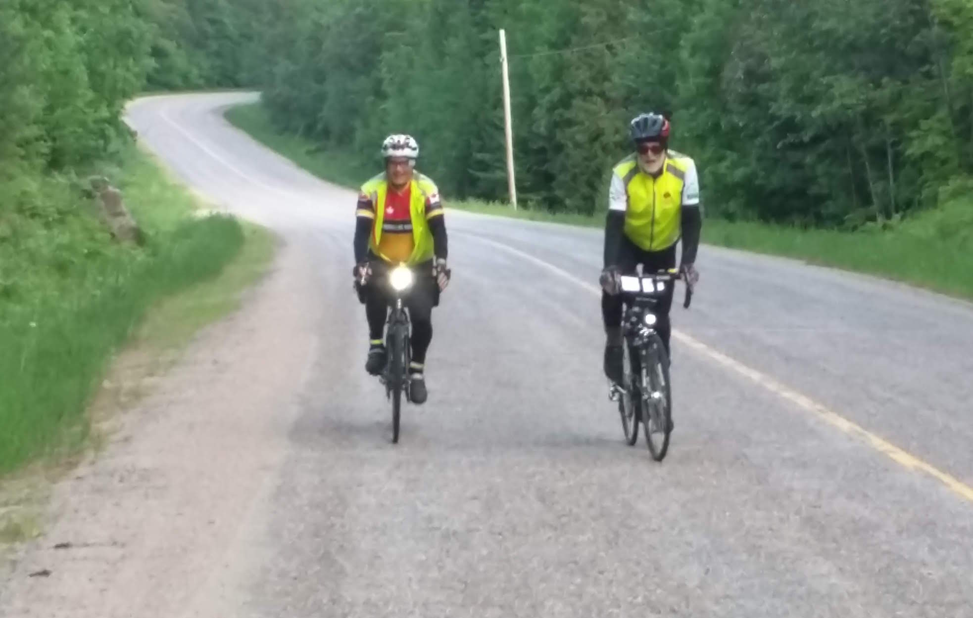
Rolling along on the Barry's Bay 600 Intro After having completed the 200, 300 and the 400km brevets this year, the remaining brevet for the 2018 Super Randonneur was a 600. With no interest in the region or next door, I looked further down the road and came across the Barry's Bay 600 in Ontario. It was the final distance in their Devil Week series, much like BC's Hell Week. While I was not ready for the full Devil Week, I did sign up for the Barry's Bay 600 in E. Ontario. For British Columbians, any brevet outside its borders may be considered flat. I'd say, not so fast. Maps of Eastern Ontario show a region dotted with lakes and streams, their presence a reflection of the topography: depressions for containment. Translated: undulating terrain, rolling hills or whatever term comes to mind. The sooner that comes to mind the better, so one can at least get and be mentally prepared. Day 1: Kanata (Ottawa) to Barry's Bay Seven dapper souls showed up at the start in Kanata on the outskirts of the nations' capital. Five had already warmed up for this event by riding the other distances in the Devil Week series. At 5:00 am we were off though Ottawa's suburban maze toward the Rideau river/canal, a marvellous work of engineering. Numerous locks and other works built to enable ships to sail from Bytown (Ottawa) to Kingston and back. It was built during pre-Confederation, opened in 1832 and is now a UNESCO World Heritage Site. The fascinating history is recounted by Robert Leggett in his excellent book Rideau Waterways (UT Press). Incidentally, swamp fever or malaria was responsible for a few deaths during construction. That was then; now we had to deal with randonneur fever. At Burritt Rapids we were to cross the Rideau, but (re)construction of the locks blocked the route. While contemplating an alternative route, we discovered a temporary foot bridge, which solved our dilemma. 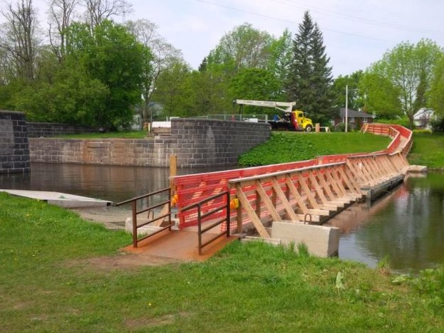
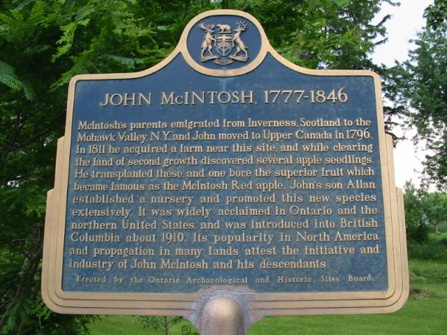
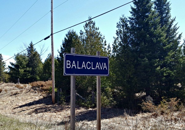
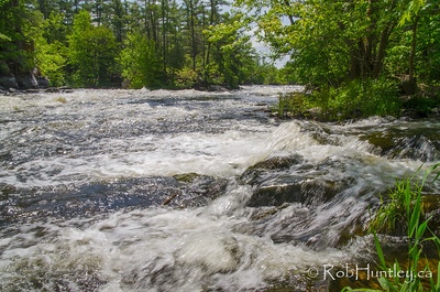
Back on the road along the river southward to our first control at Merrickville (Km 58) for a brief stop. For me we were getting into familiar terrain. It was the area where we spent our first year in Canada back in the early seventies before we moved west. There were the many apple orchards near Easton's Corner, not far from the birthplace of the red McIntosh apple. The farm was recently in the news as this piece of Canadian history was for sale. As we passed wetlands red-winged blackbirds got rather excited as they saw us as a threat. They made lots of noise to scare us off. We passed Wolford Public school. Near Jasper (Ontario) we paralleled the Ottawa-Kingston rail-line. A few times per day the train would saunter through the area, frequently tooting its horn and warning traffic of its oncoming. There was Ray Smith's farm implement dealership, decades later still in business serving the rural community. Now there are many solar farms harvesting sunrays to be converted to electricity. Turned on to Kitley Line Road # 3, only a stone throw from my cousin's farm. We crossed Hwy 29, then negotiated a few acute turns, one of which was in (holy) Toledo. This one thrusted us in to a headwind. Despite this, we maintained a good pace. At the dairy at Forfar (Km 111.0) we took a break, got our control cards signed, refilled our water bottles and ingested a few snacks. Then back on the road. While the sun was shining, the wind kept coming our way, so did the rollers. At Crossby we left the main road and serpentined our way on backroads through farmland and forest, a very pretty landscape. Some fields were still enclosed by cedar rail fences. Very rustic. A farmer was cutting hay by pulling a haybine behind the tractor, and leaving perfect patterns of long and thick swaths of grass behind in the field. This triggered a few flashbacks as I had done the same work a few decades ago. The terrain between Jones Falls and Battersea became more challenging, short and snappy climbs. Some riders began to attack them with a vengeance; they had more nerve than I did. I'd say they were audacious. I took a somewhat longer perspective. There were a lot of clicks left to be covered, so I cooled the urge to follow and rode my own pace. After all - and it cannot be said enough - there is no use burning up/out at an early stage in the ride. While I had been looking forward to soup at the Sunbury Control (Km 161), there was nothing of the kind in the General Store. So settled - albeit disappointingly - for something else: cheese dogs and refreshments. The leg after Sunbury was beautiful with extensive forest cover, rock outcrops, flowering plants, beautiful lakes and rollers forever, intermittently sprinkled with steep scarps. Looking at my shirt sleeves and handle bar bag, I noted this green sheen. Not sure whether I was turning into Martian, but then figured out that is was pollen settling down. Interesting. Via Inverary and further down the road, Missouri, we made to Westport. The Westport control (Km 202) was at a local bakery. I got some coffee and inquired about soup. The reply was: "No, no, we don't have that. We are a bakery!!" Ok, so this was a bakery. Fine, I got that. But then a bit later, someone came out with a huge ice-cream cone! And here I thought this place was a bakery. Not sure how you bake ice cream, but then again, they were a bakery. How could I not know that! Go figure. No soup! Instead of figuring this out, we got back on the bicycle and continued. Getting out of Westport is always an uphill battle, because that’s what it was: uphill. No further explanation necessary. Back onto the Frontenac Axis via Bolingbroke - with few flashbacks to a brevet I rode here in 2009 -- to Crow Lake. I was really looking forward to the next control at Sharbot Lake (Km238) -- to be more precise for an opportunity to find and eat soup. Vytas and Colleen had set up a very good food stop in the parking lot of a restaurant. I had to check the restaurant first, and yes, it had soup, and yes it was ready, and yes, they'd serve me. Finally, after two unsuccessful tries, there was soup. I was in there like a (and likely with my) dirty shirt. And it was good soup. So was the food from the support. After Sharbot Lake, it got lonely and quiet on the road. Traffic was sparse. The only thing plentiful: rollers and more rollers. It also looked like we were entering the middle of nowhere. "Nowhere, what is that?" one may wonder. However, if you are somewhere, not just anywhere, it can't be nowhere, because you are there. So, having settled that nowhere thing philosophically, we safely proceeded to the next control at Plevna (Km 283). By the time we arrived there, dusk was setting in. Plevna was established in 1860 and first called Buckshot. The Post Office Department did not like the name and issued an ultimatum: "you either change the name or we’ll do it for you." Apparently, that got people's attention. After much debate they picked Plevna. One resident commented that all this debate over the selection of a new name reminded him of the situation that was ongoing in Plevna, Bulgaria, at the time. After leaving Plevna (in 2018) without any debate, we turned onto Buckshot Lake road, which meant – much to my liking -- that for the next 31.6 km we did not have to pay any attention to Near Denbigh (Km 325) Peter and I stopped to sign each other's card as there was no sign of life to do this for us. Energy-wise, I was getting rather low, however a few of Peter's jellybeans provided the necessary boost. Whatever Denbigh's consisted of, we did not see much in the dark, except that we were treated to unexpected light shows from fireflies, lightning up their whereabouts. Neat. We continued and made it to the intermediate control at Km 343 at Heartwood Lake. By that time, I had trouble staying awake and decided to take a snooze at the mobile control. While it delayed my progress, it was worth it. Another 43 kms to go to Barry's Bay. The climbing was behind us and the profile leveled out. This made the going easier. So, we kept on going, and going as the darkness tried to swallow us. Where were we now? I began to feel placeless. Timeless, this eternity thing. Where was Barry's Bay (Km 386)? I had seen it on a map, booked a hotel room there, so it must exist somewhere. Although in this virtual world, one never knows. Well, finally there is was. A quick after mid-night snack at Tim's, and off for a few hours horizontal. Day 2: Barry's Bay to Kanata (Ottawa) At 5:40 am the alarm went off. While a bit groggy, I was able to get it all together. By 6 am we were back at Tim's for oatmeal porridge and the necessary liquids. A few of the riders took off; I left a bit later, hoping to catch up in the first half hour or so. The instructions left were: "Just follow last night's road and you'll be fine". It was not quite that simple, because last night's road was pitch dark and I did not record much of that road. I don't think anyone else did. That morning however, everything was bright and looked perfect. As it turned out, everything was not fine. Meanwhile - fast forward 160 years to 2018 - I kept looking for this left-hand turn onto the Hopefield Road. It was not to be found. Getting lost is of course a rando's worst nightmare, even in bright daylight. Doubt started to set in, so I decided to do a U-turn and stopped at the Esso station on the Barry's Bay side of Wilno. I bought a map and received instructions (free) from the locals. It helped in that I was able to get back on track, and eventually found that famous left turn onto the Hopefield Rd. I was ok now. The road kept on climbing. I even walked a short steep section, keeping in mind that when Jan Heine says: "it is ok to walk up a steep hill" it is ok. And it was indeed ok. Finally, I reached the highest point of the brevet at Foymount, the location of a former Canadian military radar base (1950's to 1974). It was part of the Canada wide Pinetree Line, an early warning system to detect possible Russian nuclear attacks from the North. A remnant of the Cold War. The joy of learning about local geography and history, while traversing the countryside. After Foymount, it was all downhill, rapidly as it applied to course. Or as the Germans so succinctly put it: "und dann haben wir uns nach Unten gestürzt" for me a reference to a steep and exhilarating downhill. At 10:00 am I sailed into Eganville (Km 450) on the Bonnechere River, a beautiful stream flowing through town. Feeding time (again). Stopped in at the local Subway and ordered the "egg and cheese with bun" from the menu, then asked to have extra egg and cheese added and a bundle of other things eliminated. Sort of a trade-off. That was just what I needed. Can't say the service At Dacre, a few kilometers down the road we paused to replenish. It was getting quite warm. The route continued through the same landscape with quiet roads. Of course, there were the necessary short climbs and brief walks. Remarkable that the pace of walking uphill was only slightly slower than the pace of the cycling effort. It took a while, but there they were: the ski hills of Calabogie Peaks, followed by the Calabogie Control (Km 503), a bit further down the road. Time for another feeding break. This time Colleen and Vytas had arranged for a power lunch: pizza, which always hits the spot. While most of the riders arrived shortly after one another, they departed in the same fashion. When my time was up, it was back on the bicycle, down to the road to the water front, then along and across the river. The roads were quiet again as I moved along easy navigation via Tatlock to Clayton. A few snappy climbs kept me on my toes from time to time, which incidentally caused the loss of a (big) toe nail a few weeks later. Clayton Control (Km 546). After another break with refreshments on the front steps of the Clayton General Store it was back in the saddle. I caught up with Peter on the Ramsey Concession Road #8. The Frontenac Axis was behind us and we were back in the Ottawa Valley. Farmland began to prevail. At Bennie's Corner, site of the Fred P. Lossing Observatory, we traversed a short Finally, with a bit of urban riding toward the end, there it was the finish in Kanata (Km 601). Finished in a time of 37:13. The finish was celebrated in style with delicious food and refreshments. Much appreciated. Thanks to (1) Peter, who designed a route with very little traffic and great scenery; (2) Guy, who was there at the start and finish with food and drink, and (3) last, but not least, Vytas and Colleen who did an excellent job of supporting the riders during this event, and of course their post-ride hospitality. To my fellow riders, thank you for the company on this brevet. Enjoyed it. Epilogue What a great ride. Certainly not for the faint of heart. The urban navigation remains a challenge; the help from those familiar with the lay of the land was much appreciated. The topography of the route consists of two relatively flat bookends, with endless rollers in the middle sandwiched between them. Up and down, just rolling along applies not only to the topography, but also to the cycling this route. It takes substantial effort and focus, which makes this brevet great training for PBP. As a bonus, the cultural landscape revealed much of its past, present and changes for those interested in observing and learning. Finally, in finishing this brevet I achieved my 10th Super Randonneur pin. It also meant being able to pre-register for PBP in late January 2019. Detailed route information:
Go to: Devil's Week 2018 (Randonneurs Ontario web site) December 16, 2018 |